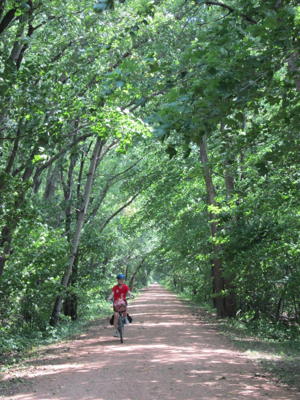
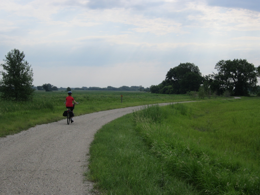
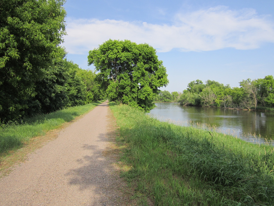
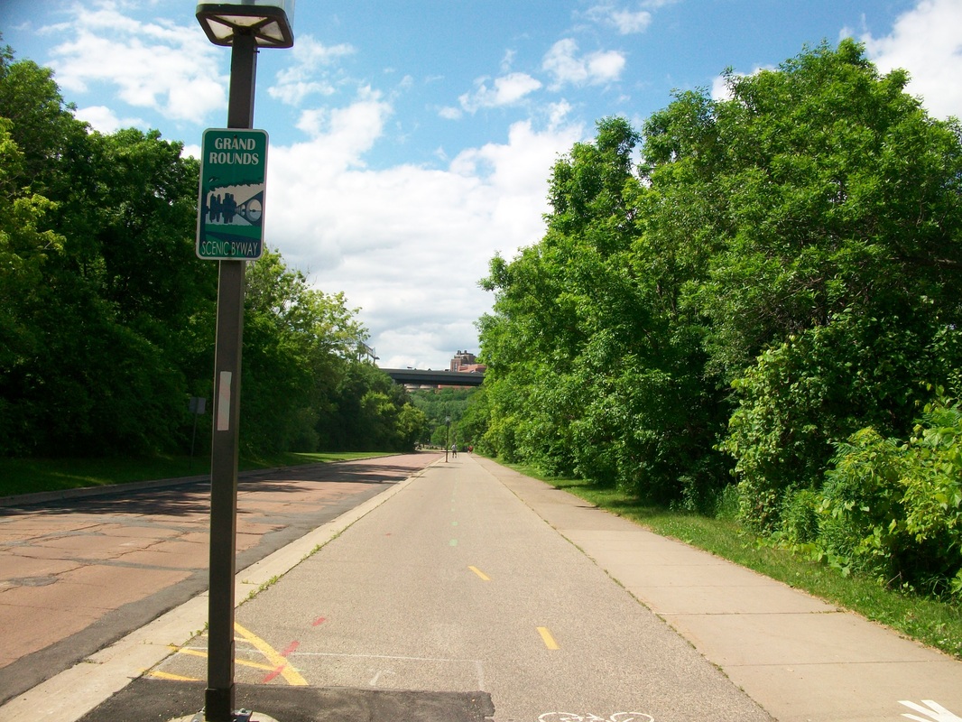
Hennepin County Trails
You'll find a bit of everything in Hennepin County, from little cruises to cross-country excursions. The honor of "best bicycling city in America" is often accredited to Minneapolis, and from its 83 miles of off-street trails, 44 miles of bike lanes, and extensive bike rental system, it's easy to see why. Anyone who loves bicycling must explore what may be the most diverse and expansive collection of trails in the country. Without further ado, here are the reviews.
(For an overall map of the Hennepin County trail system, click here, then click "Bike Maps".)
(For an overall map of the Hennepin County trail system, click here, then click "Bike Maps".)
Image above courtesy http://www.brooklynpark.org/sitepages/pid1336.php.
Trails in Hennepin County
Rating 5:
Rating 5:
Rating 4 ½:
Rating 4:
Rating 3 ½:
Rating 3:
Rating 2 ½:
Rating 2:
Suggested Rides in Hennepin County
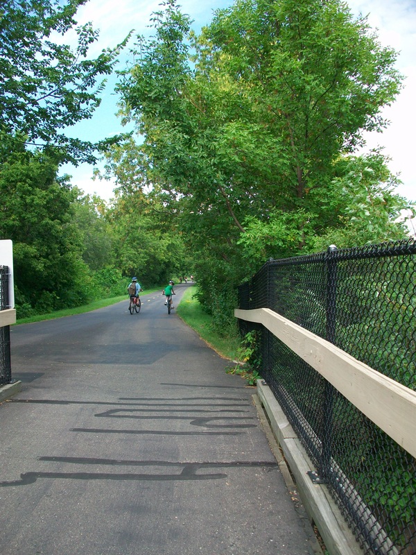
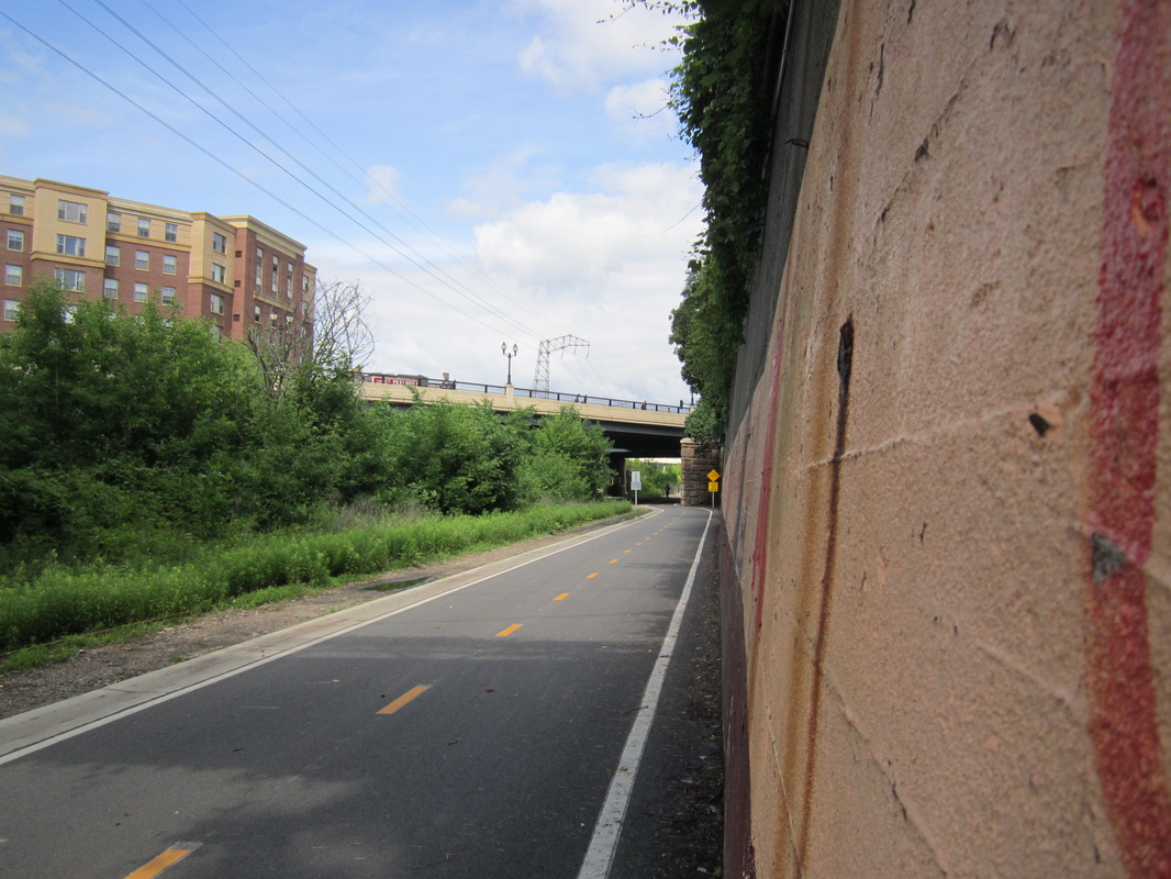
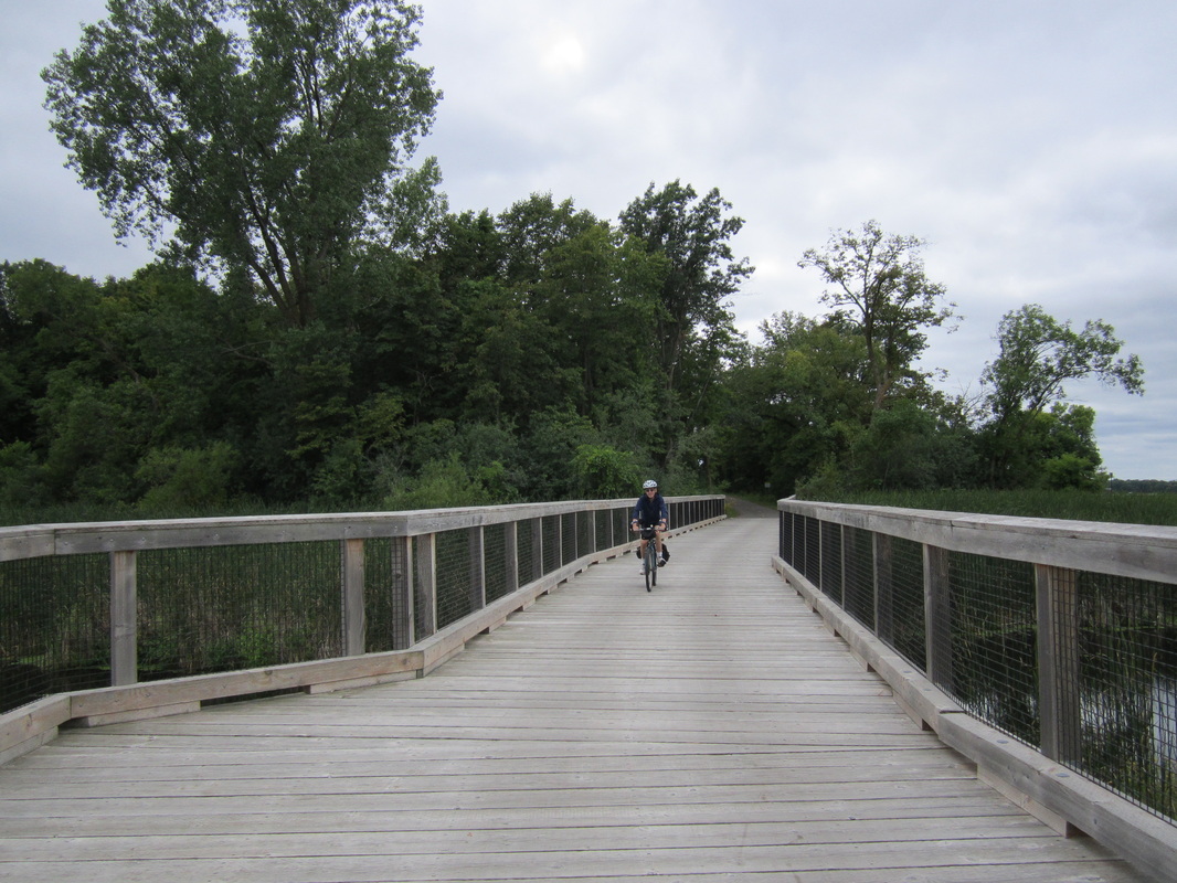
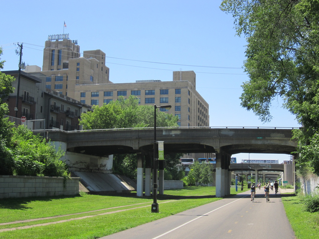
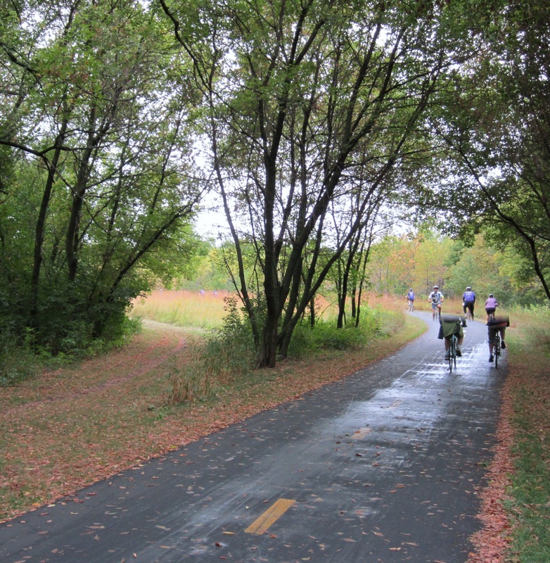
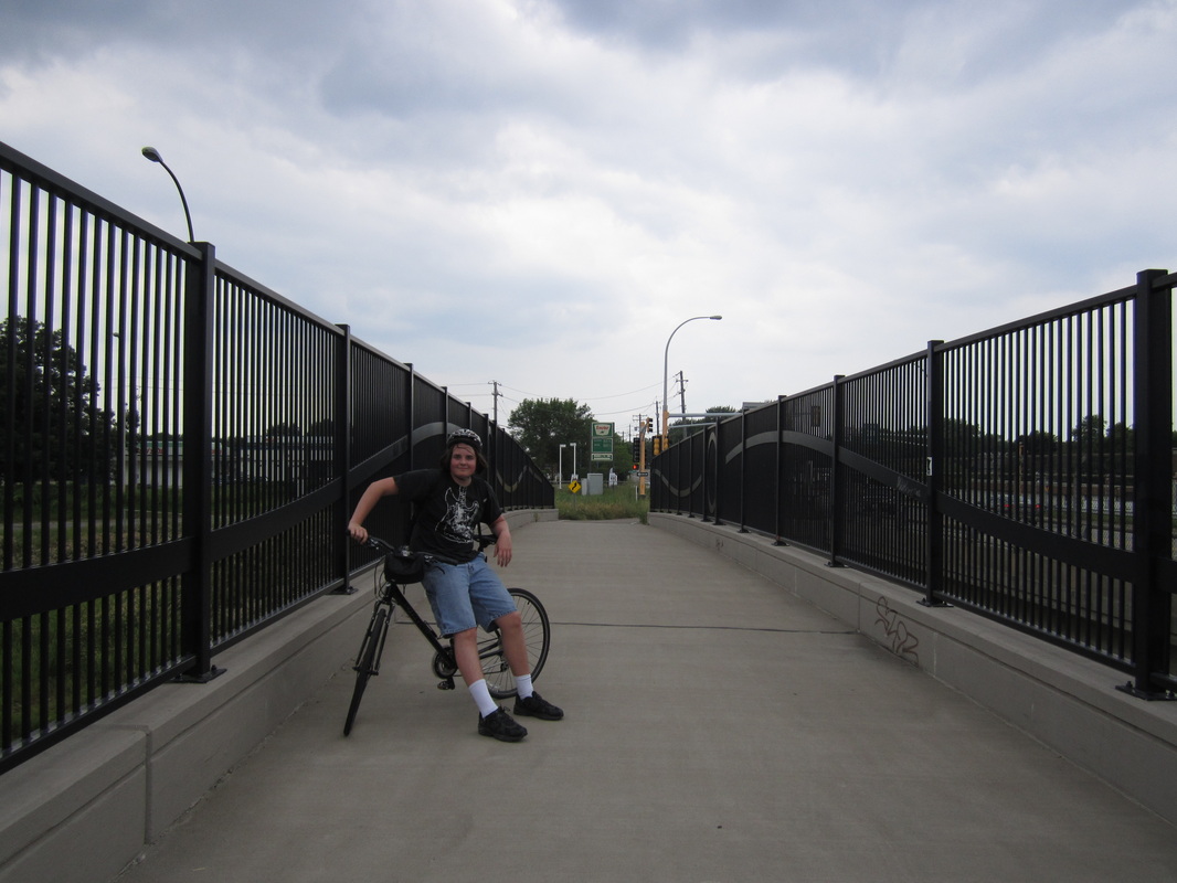 The Bassett Creek Trail crosses US-169 on a bridge.
Bassett Creek Regional Trail
Length: 2.0 miles
Rating: 2 / 5
Surface: Asphalt
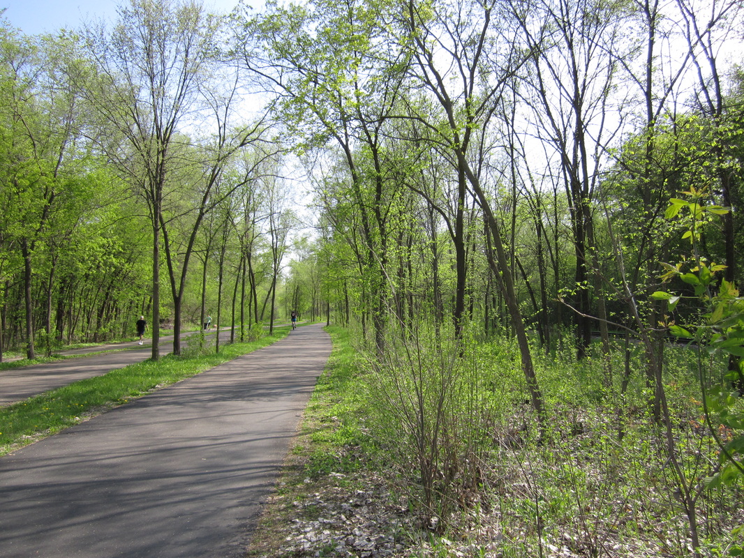
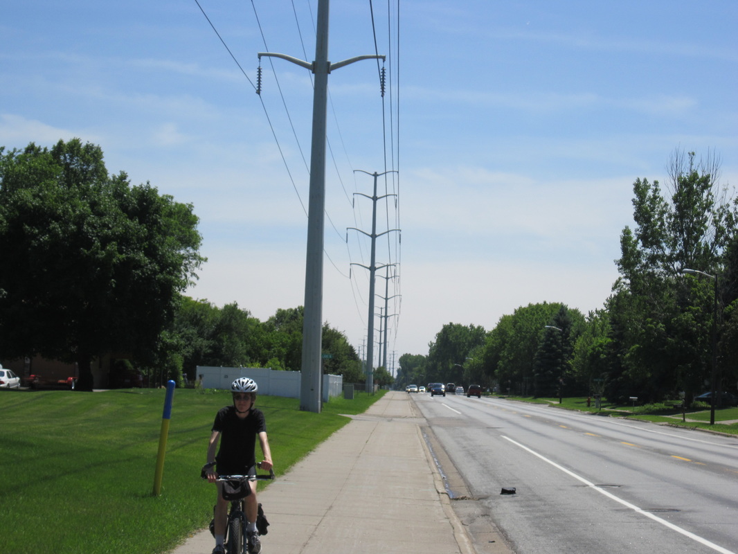
The Bassett Creek Trail's current incarnation is a very unexceptional spur off of the Medicine Lake Loop, paralleling 36th Avenue to New Hope. The pavement is bumpy and signage is lacking. This trail is a work in progress, and will one day connect to Theodore Wirth Park and the Grand Rounds, for a total length of seven miles. The map linked below shows the trail as connecting Boone Avenue and Winnetka Avenue, however, this section is not complete as of August 2014 -- instead, there is a spur that heads south from 36th to Hidden Valley Park.
(Last biked Sunday, August 10th, 2014, 1 PM to 3 PM)
UPDATE (7/26/17): According to Three Rivers Park District, this trail has been extended and five of its seven miles are now complete.
Go to http://www.threeriversparks.org/trails/bassett-creek-trail.aspx for a map and information on the Bassett Creek Trail.
Length: 2.0 miles
Rating: 2 / 5
Surface: Asphalt
The Bassett Creek Trail's current incarnation is a very unexceptional spur off of the Medicine Lake Loop, paralleling 36th Avenue to New Hope. The pavement is bumpy and signage is lacking. This trail is a work in progress, and will one day connect to Theodore Wirth Park and the Grand Rounds, for a total length of seven miles. The map linked below shows the trail as connecting Boone Avenue and Winnetka Avenue, however, this section is not complete as of August 2014 -- instead, there is a spur that heads south from 36th to Hidden Valley Park.
(Last biked Sunday, August 10th, 2014, 1 PM to 3 PM)
UPDATE (7/26/17): According to Three Rivers Park District, this trail has been extended and five of its seven miles are now complete.
Go to http://www.threeriversparks.org/trails/bassett-creek-trail.aspx for a map and information on the Bassett Creek Trail.
_________________________________________________________________________________________________________________________________________________________
Cedar Lake Regional Trail - Partially closed until Fall 2021
Length: 4.4 miles
Rating: 3 ½ / 5
Surface: Asphalt
Note: Partially closed due to Southwest LRT construction until Fall 2021. For more info visit:
https://www.minneapolisparks.org/news/2019/05/15/cedar-lake-trail-and-kenilworth-trail-close-on-monday-may-13/
Minnesota's first "bike freeway" begins along the river on the north side of Downtown Minneapolis, and connects to the Chain of Lakes and Grand Rounds. It is a commuter's dream. Much of the portion east of the junction with the Kenilworth Trail is very industrial, with the usual type of freeways crossing the trail left and right. Recreational cyclists come for the western section's great views of Cedar Lake and restored grassland. There's also an interesting section inside Northstar Commuter Rail's Target Field station (some of the only shade on the whole trail).
(Last biked Saturday, August 5th, 2017, 10 to 11 AM)
_________________________________________________________________________________________________________________________________________________________
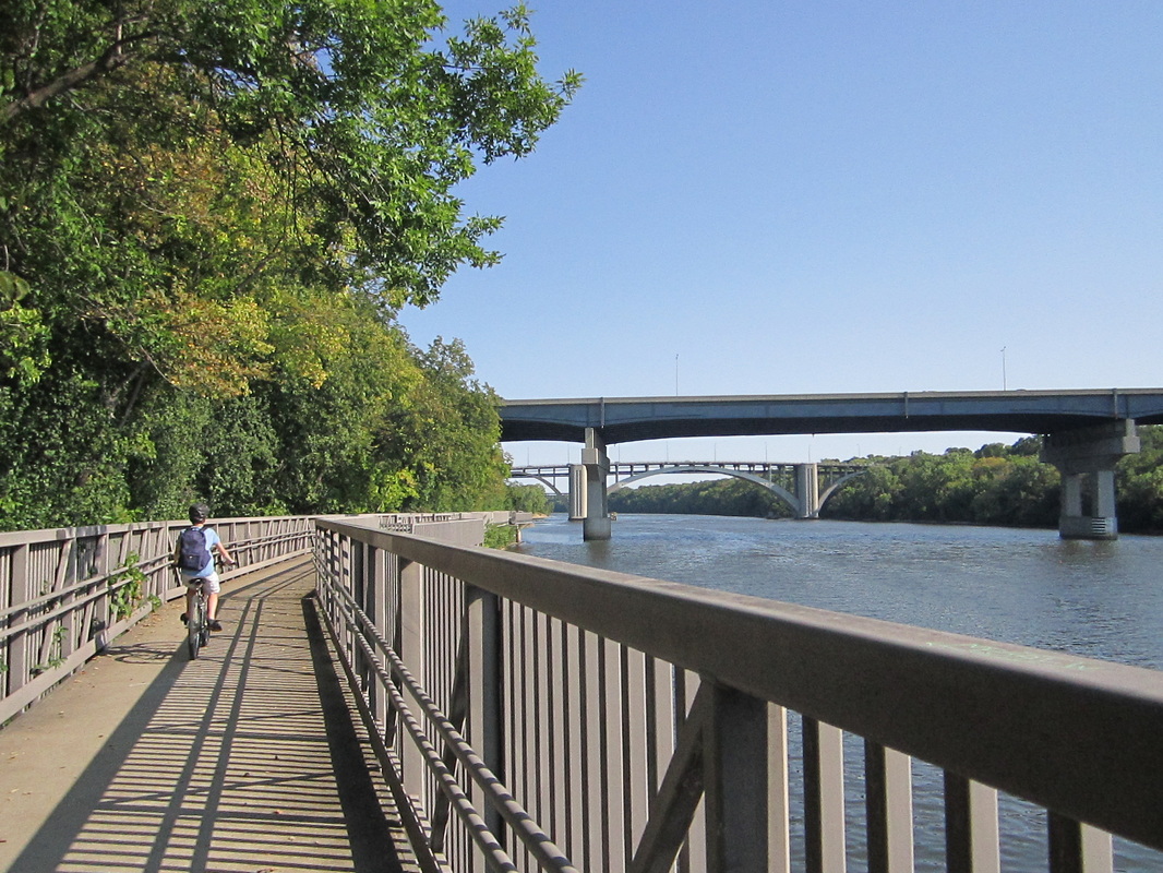
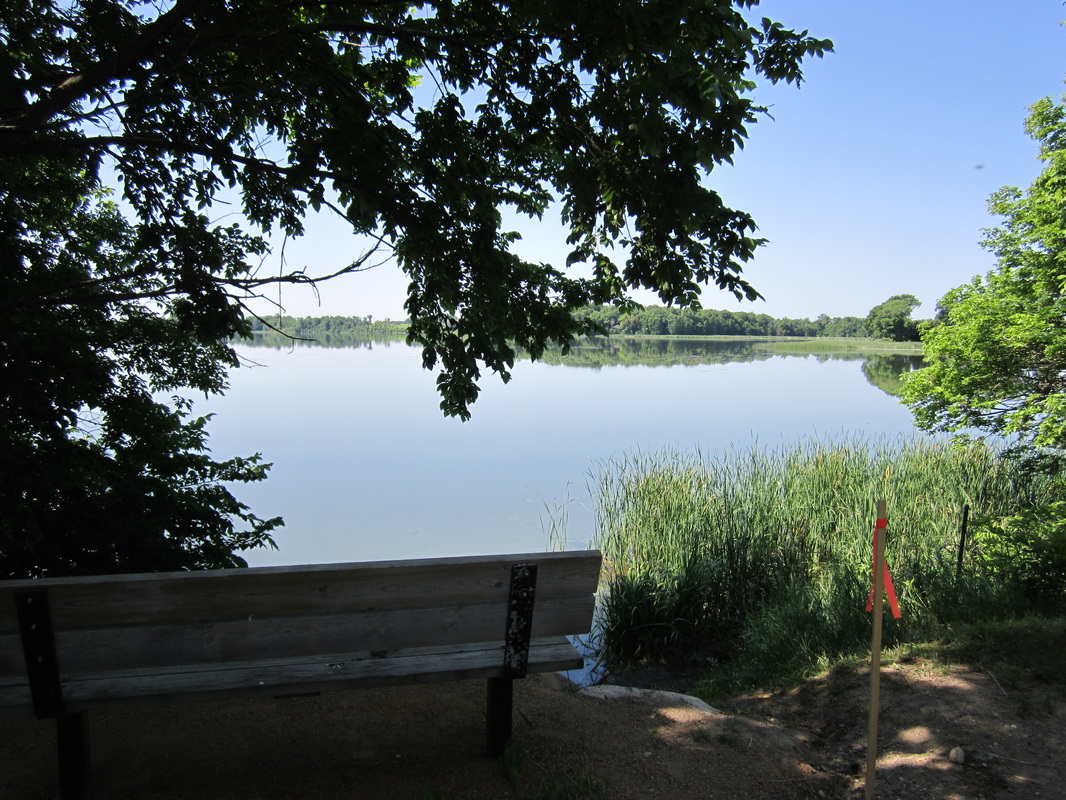
 The Cedar Lake LRT Trail crosses a bridge.
Cedar Lake LRT Regional Trail (previously called Southwest LRT Trail: East Corridor)
Length: 3.6 miles
Rating: 3 ½ / 5
Surface: Asphalt
The Midtown Greenway becomes the Cedar Lake LRT Trail as it leaves Minneapolis. Paralleling a railroad grade, it is a quick, direct way to get from Minneapolis to Hopkins. It's popular and has no real distinguishing characteristics, but is surrounded by leaves, and its straightaways are good for picking up speed.
(Last biked Saturday, August 5th, 2017, 2 PM to 3 PM)
Go to http://www.threeriversparks.org/trails/cedar-lake-trail.aspx for a map and information on the Cedar Lake LRT Regional Trail.
___________________________________________________________________________________________________________

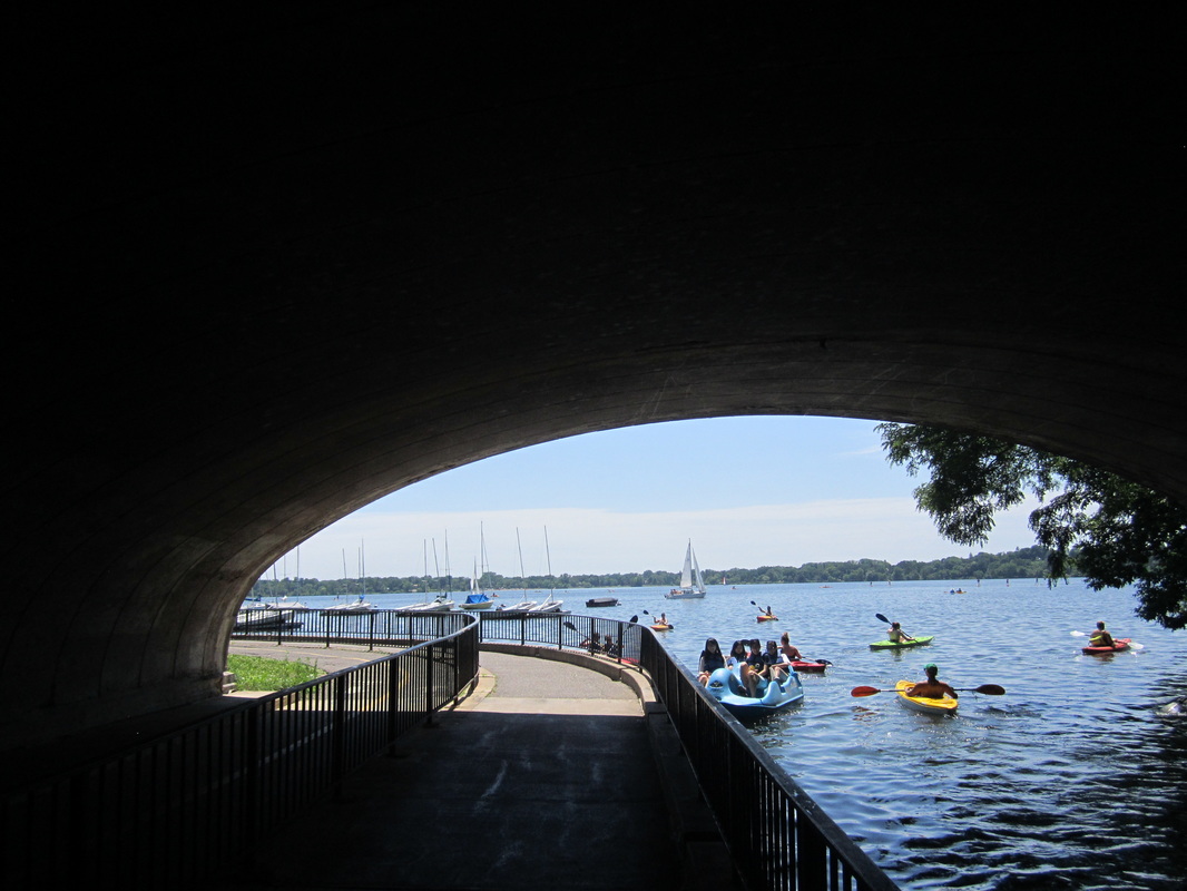
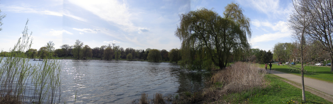
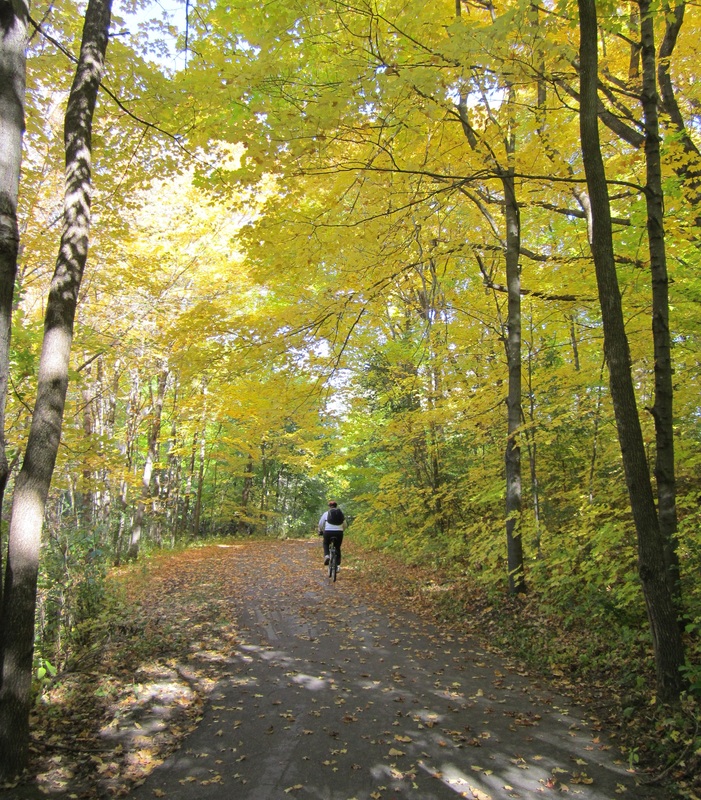
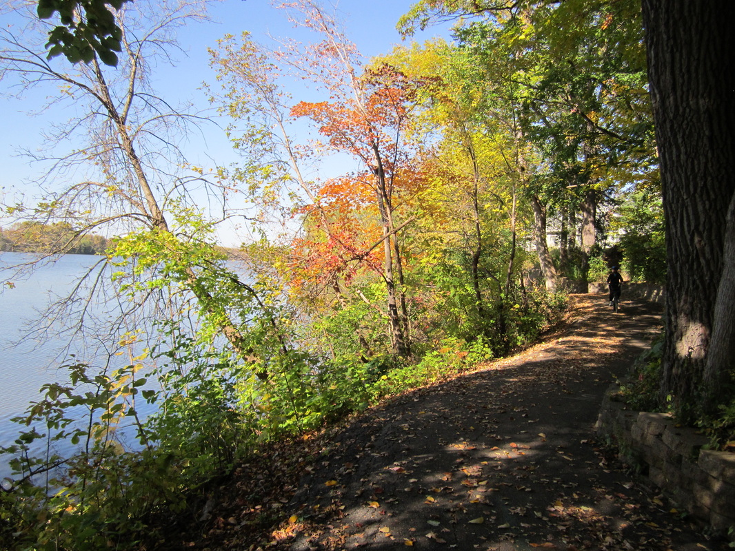
Chain of Lakes Trail(s) (part of Grand Rounds National Scenic Byway)
Rating: 4 / 5
Surface: Asphalt
Minneapolis calls itself the city of lakes -- an apt name for a city with over a dozen. The four largest and most iconic form a chain, and they are popular among boaters, bicyclists, walkers, swimmers, and anyone who wants to see and be seen or relax in pretty surroundings.
Bde Maka Ska and Lake Harriet (6.9 mile loop): Big, round, and sailboat-studded, these two lakes and especially the trail between them are extremely busy, which is why the loop parts of the trails have been widened (they could use repaving, however). Lake Harriet, the deeper of the two, is bordered in many places by shady woods, which are pleasant to ride through and comparatively quieter. Larger and sunnier, Bde Maka Ska (Lake Calhoun) includes picturesque views of the Minneapolis skyline across the water.
(Last biked Saturday, June 18th, 2016, 3 PM to 4 PM)
Lake of the Isles Loop (2.8 mile loop): From Lake Calhoun, weave along Minnehaha Creek, under Lake Street and the Midtown Greenway, to find Lake of the Isles. There are indeed two wooded islands (Mikes and Raspberry) in this pretty and irregularly shaped lake. Loop is one-way clockwise.
(Last biked Sunday, May 18th, 2014, 3 PM to 6 PM)
Cedar Lake Parkway Trail (1.6 miles one way): Newly redesigned connector trails along Dean Parkway take you from Calhoun and Isles to Cedar Lake Parkway, which might be the least-ridden portion of this trail (though that isn't saying much). Many-bayed Cedar Lake feels refreshing just to ride by. You can make a loop around it using the Cedar Lake and Kenilworth "bike freeways." To continue north from Cedar Lake rather than looping, veer left, up the hill, to follow a ridge overlooking tiny Brownie Lake (but the trail gets narrow and bumpy at this point, so I wouldn't recommend it).
(Last biked Sunday, May 18th, 2014, 3 PM to 6 PM)
The Chain of Lakes Trails are dark blue on this map.
_______________________________________________________________________________________________________________________________________________________
|
Columbia Parkway Trail (part of Grand Rounds National Scenic Byway)
Length: 0.8 miles Rating: 4 ½ / 5 Surface: Asphalt This tiny, hilly trail follows Columbia Parkway along the edge of Columbia Park and the Columbia Golf Course, then goes over a hill to ends at Central Avenue. You can make a complete loop around the Columbia Park & Golf Course using a trail next to Central Avenue and the Saint Anthony Parkway Trail. (Last biked Saturday, April 20, 2013, 2 PM to 4 PM) The Columbia Parkway Trail is yellowish-green on this map. |
 The Columbia Parkway Trail |
_________________________________________________________________________________________________________________________________________________________

|
Dakota Rail Regional Trail
Length: 26.7 miles Rating: 5 / 5 Surface: Asphalt This might be the best rail trail in the Twin Cities metro. The most popular section crosses Lake Minnetonka on an island and a peninsula, but I think the trail gets even prettier after it leaves the lake behind. Beginning in Wayzata, the trail soon crosses a trestle into Lake Minnetonka, which is really a maze of many lakes. The cottages and estates of the shoreline communities are quiet and quaint, such that the occasionally comical lack of crosswalks is not usually a problem. After more occasional glimpses of the lake, the trail heads west, alternating between rolling countryside scenery and a tunnel of trees. If you stick with it past Saint Bonifacius to Mayer, you'll find middle-of-nowhere forest and a spectacular stretch right along the shoreline of big Lake Waconia. The final, newest portion of the trail is a straightaway on the prairie, ending at the Carver/McLeod county line. (Last biked Wednesday, July 2nd and Thursday, July 3rd, 2014) Go to http://www.threeriversparks.org/trails/dakota-rail-trail.aspx for a map and information on the Hennepin County section of the Dakota Rail Trail. Go to https://www.co.carver.mn.us/home/showdocument?id=5839 for a map and information on the Carver County section of the Dakota Rail Trail. __________________________________________________________________________________________________________________________________ |
THE NUMBERS:
Wayzata to Mound: 8.3 miles Mound to St. Boni: 4.6 miles St. Boni to Mayer: 7.9 miles Mayer to New Germany: 4.0 miles New Germany to end: 1.9 miles |
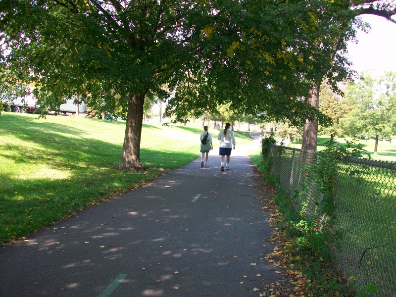
Dinkytown Greenway
Length: 1.2 miles
Rating: 3 / 5
Surface: Asphalt
The Dinkytown Greenway is another important step in making every corner of Minneapolis perfect for commuting bicyclists. Next to a railroad grade, it smoothly zooms under bridges a story below Dinkytown, connecting Stadium Village and the U of M Transitway with Downtown Minneapolis. It's not at all a destination in itself, with the primary scenery being railroad tracks and walls. The exception to this is the gorgeous bridge across the Mississippi River, which can be used by recreational bicyclists to get from Minneapolis to the beginning of the East Mississippi River Gorge Trail.
(Last biked Wednesday, June 18th, 2014, 4 PM to 5 PM)
_________________________________________________________________________________________________________________________________________________________
The East River Flats Trail's river walk.
East River Flats Trail
Length: 1.5 miles
Rating: 4 ½ / 5
Surface: Asphalt & Concrete
The little East River Flats Trail, in Minneapolis's East River Flats Park, lets you glide among trees and grasses below the river bluff, and even across the Mississippi's surface on an elevated “river walk.” Though near the geographic center of the cities, this floodplain feels amazingly remote. The trail begins at a parking lot on the U of M campus, along the East River Trail, and ends at an unmarked service road near the Saint Paul border. There are gently rolling hills when you're on land, but nothing serious unless you're going up the bluff on the service road. The pavement is a bit bumpy but decently maintained, and the portion below the Franklin Avenue Bridge is usually underwater during spring flooding.
(Last biked Saturday, September 6th, 2014, 11 AM to 1 PM)
ALERT: The East River Flats Trail is closed under the Franklin Avenue Bridge. As of May 2017, it remains closed due to reconstruction of the bridge.
_________________________________________________________________________________________________________________________________________________________

|
Elm Creek Park Trail(s)
Length: Full loop 14.6 miles (see more distances at right) Rating: 5 / 5 Surface: Asphalt Elm Creek Park Reserve, the largest park in the metro, is home to this spectacular bike circuit. You'll travel over rolling hills through nearly unspoiled landscapes, with few signs of civilization besides other bicyclists (and even they become rare in the park's northern reaches). The trail alternates between pristine prairies and lush corridors of forest, with occasional lakes, creeks, wetlands, and panoramas from high spots. Watch for distant waterbirds when you pass through the hills above Leman Lake (near Champlin), a wildlife sanctuary. And if you're not doing the full loop, stop at the overlook above Mud Lake, from which you can see all the way to the striking red roof of the Elm Creek Chalet. All of these sights are taken in from perfectly smooth pavement, common on the well-maintained trails of the far Northwest Metro. (Last biked Satruday, October 11th, 2014, 12 PM to 2 PM) Go to https://www.threeriversparks.org/location/elm-creek-park-reserve for a map and information on Elm Creek Park Reserve. __________________________________________________________________________________________________________________________________ |
THE NUMBERS
Around Mud Lake: 4.9 miles Full South Loop: 7.2 miles North Loop: 11.0 miles Full Loop: 14.6 miles |


Hiawatha LRT Trail
Length: 4.7 miles
Rating: 2 / 5
Surface: Asphalt & Concrete
This trail parallels the Blue Line light rail from Minnehaha Parkway to US Bank Stadium. The portion south of the Midtown Greenway is relatively pointless, stuck on a double sidewalk between the Light Rail line and Hiawatha (Highway 55). (It's even inconvenient for commuters, since you have to stop at every light. Why not just ride the train? You can take your bike on board.) North of the Greenway, however, things are more interesting, and the trail starts to feel like an actual bike trail as it turns to asphalt and signage begins. It follows the LRT line away from Hiawatha, passing through the charismatic Cedar-Riverside neighborhood as it heads into downtown. Train enthusiasts can stand right at the confluence of the Blue and Green Lines and observe the almost never-ending flow of trains.
(Last biked --
Southern: Monday, May 28th, 2012, 11 AM to 2 PM
Northern: Saturday, September 6th, 2014, 11 AM to 1 PM)
_________________________________________________________________________________________________________________________________________________________
The Kenilworth Trail
Kenilworth Regional Trail - Closed Summer 2022
Length: 1.5 miles
Rating: 4 ½ / 5
Surface: Asphalt
Note: Closed due to Southwest LRT construction until Summer 2022. For more info visit.
https://www.minneapolisparks.org/news/2019/05/15/cedar-lake-trail-and-kenilworth-trail-close-on-monday-may-13/
This convenient link will make a wonderful part of your bike ride. It connects the Cedar Lake Trail to the Midtown Greenway, between Cedar Lake and Lake of the Isles. Though your views of those lakes will be limited, the trail itself is cloaked in a wonderful covering of trees. It is also a "bike freeway," with three separate lanes for walkers, north-going bikers, and south-going bikers.
(Last biked Saturday, October 4th, 2014, 1 PM to 2 PM)
Go to http://www.minneapolismn.gov/www/groups/public/@publicworks/documents/webcontent/convert_272206.pdf to download a very old, but still accurate, PDF map of the Kenilworth Regional Trail.
_________________________________________________________________________________________________________________________________________________________

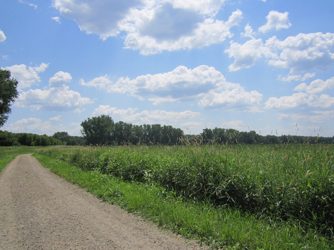
Lake Independence Regional Trail
Length: 15.9 miles
Rating: 3 ½ / 5
Surface: Mostly asphalt, some concrete and on-road
At its best, the Lake Independence Trail showcases a wonderful slice of lake country among the farm fields of far western Hennepin County. The first two miles of the trail, along a paved but modest country road, link the Luce Line Trail to Baker Park Reserve, which offers similar scenery to Elm Creek Park in Maple Grove. The highlight of the trail is the deservedly popular Lake Katrina Loop, which showcases both the lake and wetlands and the rolling hills around, which are sprinkled with pockets of dense forest and meadow. In the north part of the park, the trail is mighty nice too, and even hillier. But don't go north of the small town of Loretto, unless you're trying to get somewhere. Unpleasant on a hot day, the trail here parallels County Road 19 through nondescript farmland.
(Last biked Monday, September 2nd, 2013, 2 PM to 5 PM)
Go to http://www.threeriversparks.org/trails/lake-independence-trail.aspx for map and information on the Lake Independence Regional Trail.
Go to https://www.threeriversparks.org/location/baker-park-reserve for a map and information on Baker Park Reserve.
_________________________________________________________________________________________________________________________________________________________

|
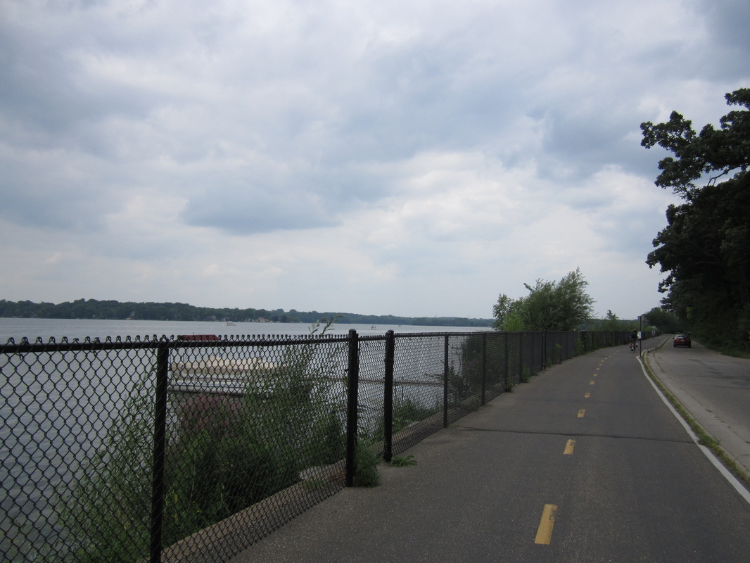
Lake Minnetonka LRT Regional Trail (previously called Southwest LRT Trail: North Corridor)
Length: 15.8 miles Rating: 4 ½ / 5 Surface: Crushed Limestone This gorgeous limestone odyssey begins in downtown Hopkins, a few blocks along a not-too-busy street from the Minnesota River Bluffs LRT Trail. The former railroad grade parallels Minnetonka Boulevard for a bit, then enters forests and wetlands. In Greenwood, the trail suddenly bursts out onto the shore of the big lake. It later appears on both sides of you as you cruise past its strangely shaped bays and coves to Excelsior, another old town in the suburbs. Beyond Lake Minnetonka, the trail remains gorgeous as it passes Virginia, Tamarack, Schultz and Stieger Lakes. It also connects to the trail system of huge Carver Park Reserve before its terminus in Victoria. (Last biked Saturday, October 4th, 2014, 2 PM to 6 PM) Go to http://www.threeriversparks.org/trails/lake-minnetonka-trail.aspx for a map and information on Lake Minnetonka LRT Regional Trail. ________________________________________________________________________________________________________________________________ |
THE NUMBERS
Hopkins to Excelsior: 8.4 miles Excelsior to Victoria: 6.4 miles |
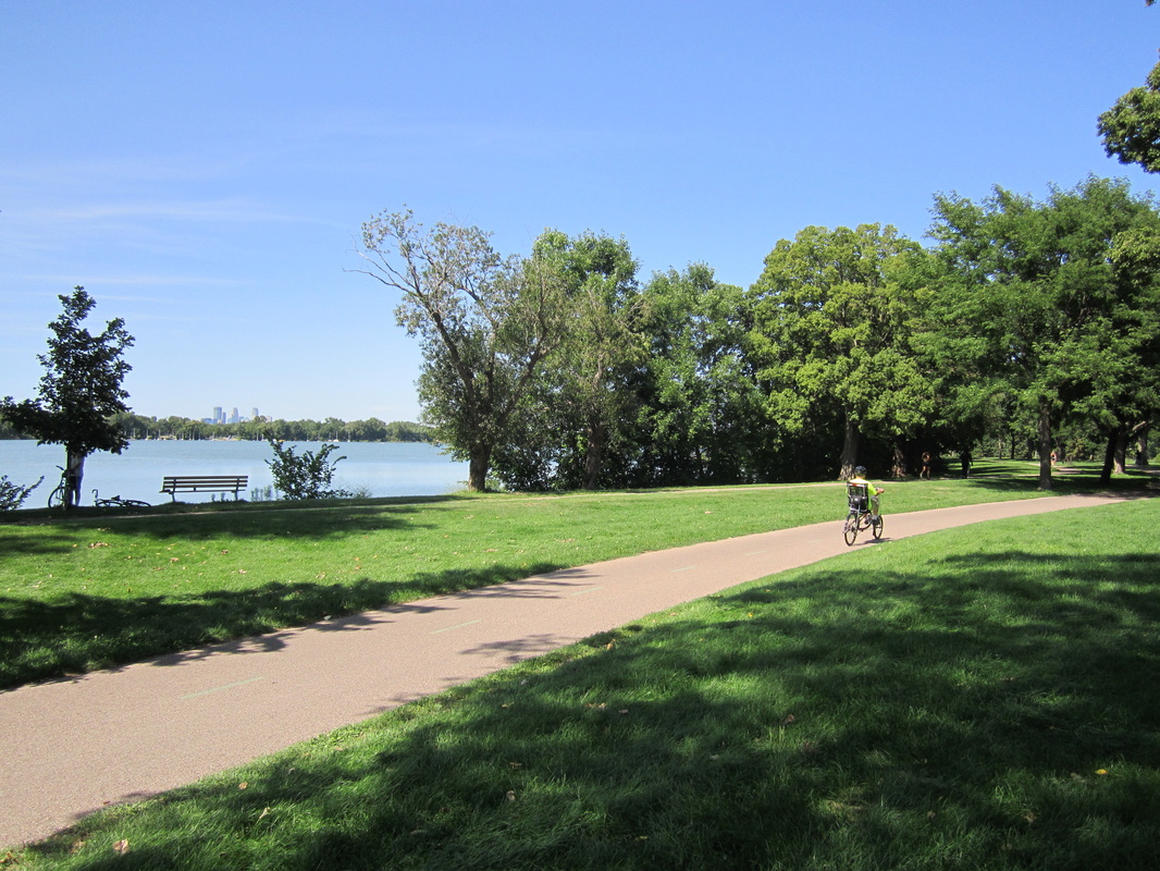
Lake Nokomis.
Lake Nokomis Trail (part of Grand Rounds National Scenic Byway)
Length: 2.8 mile loop
Rating: 4 ½ / 5
Surface: Asphalt
Despite the fact that the lake has two popular swimming beaches and is crossed by Cedar Avenue, as well as a major flight path, Nokomis's traffic is moderate when compared to lakes like Calhoun and Harriet. The beauty of the lake and its surrounding large trees add to the many reasons to bike this worthwhile corner of the Grand Rounds. A 500-foot spur trail links Nokomis with the Minnehaha Parkway Trail. Loop is two-way.
(Last biked Saturday, June 20th, 2015, 11 AM to 12 PM)
The Lake Nokomis Trail is purple on this map.
______________________________________________________________________________________________________________________________________________
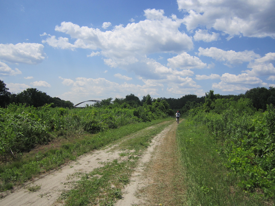
Long Meadow Lake Trail
Length: 3.5 miles
Rating: 3 / 5
Surface: Gravel and Natural Surface (dirt & sand)
The Long Meadow Lake Trail follows an old gravel road along the shore of aptly named Long Meadow Lake (it looks more like a meadow than a lake), with occasional views of the Minnesota River and one of its oxbow lakes. The trail is in the Minnesota Valley National Wildlife Refuge, connecting the visitor center to the Cedar Avenue (77) Bridge. The Minnesota valley is a beautiful place, but the trail is mostly out in the open with little shade, and it gradually turns to pure sand -- prepare to be walking your bike quite a bit during the last mile.
(Last biked Tuesday, July 10th, 2012, 12 PM to 3 PM)
Go to http://maps.google.com/maps/ms?ie=UTF8&hl=en&msa=0&msid=102925051487865004265.000479206ba7ac7de11f0&ll=44.80084,-93.342934&spn=0.090013,0.154324&t=h&z=13 for a map of the South Bloomington Trail Network (the Long Meadow Lake Trail is green).
_____________________________________________________________________________________________________________________________________________
Luce Line State Trail
Length: 63 miles
Avg. Rating: 4 / 5
Surface: Crushed limestone (Plymouth to Winsted), asphalt (Winsted to Hutchinson), crushed aggregate base (Hutchinson to Cedar Mills) & mowed grass (Cedar Mills to Cosmos)
The magnanimous Luce Line ranks among Minnesota's greatest trails. This converted railroad grade stretches a whopping 63 miles due west from Plymouth to tiny Cosmos. Though the first few miles and the few miles in Hutchinson are very popular, most of the trail is quite remote, featuring long stretches where you will likely see more deer than people.
Eastern Portion: Plymouth to Winsted (30 miles, rating 5)
The well-maintained crushed limestone section from Plymouth to Winsted lends itself to both great day trips and pleasant small outings. The Luce Line Extension takes you from Minneapolis to the official trailhead. From there, the crowds taper with the development, and after several miles you may find yourself alone in the beauty of the “big woods” ecosystem. The trail follows a tunnel of trees past suburbia, then farm fields, wetlands, and lakes like pristine Oak Lake. Beyond bike-friendly Watertown, a particularly nice 10-mile stretch follows deep woods through the farmland, crossing streams with chances to see wildlife. The crushed limestone portion of the Luce Line ends in Winsted, a quiet town on a pleasant, pelican-filled lake.
(Last biked July 5, 2013)
Western Portion: Winsted to Cedar Mills (23 miles, rating 4)
The trail starts up again about a mile west of Winsted, completely unmarked. Directional and road signage was absent when I biked this trail in 2013, but it may be present now that this section has been paved with asphalt. The “big woods” gradually gives way to remnants of tallgrass prairie, the trail alternating between pockets of woods and stretches of grassland. The section in and around Hutchinson is a gem, following the South Fork of the Crow River through town. West of Hutchinson, where the trail turns to rougher crushed aggregate base, its better moments come when it moves away from Highway 7 (which it parallels), and lends itself to more wood and prairie scenery.
(Last biked July 5, 2013)
Far Western Portion: Cedar Mills to Cosmos (10 miles, rating 1 ½)
The prairie flora begins to appear right under your bike tires when the trail surface turns to infrequently mowed grass upon passing through Cedar Mills (population 45). Solitude is the word out here, and there's a bit of prairie scenery, but the unkempt-lawn-style surface makes biking this section difficult and exasperating. Cosmos is a cute little space-themed town, and a short crushed limestone segment beyond it takes you to the official end of the trail, at pretty and quiet Thompson Lake.
(Last biked July 4, 2013)
Go to http://files.dnr.state.mn.us/maps/state_trails/luce_line.pdf to download a PDF map of the Luce Line State Trail.
________________________________________________________________________________________________________________________________________________________
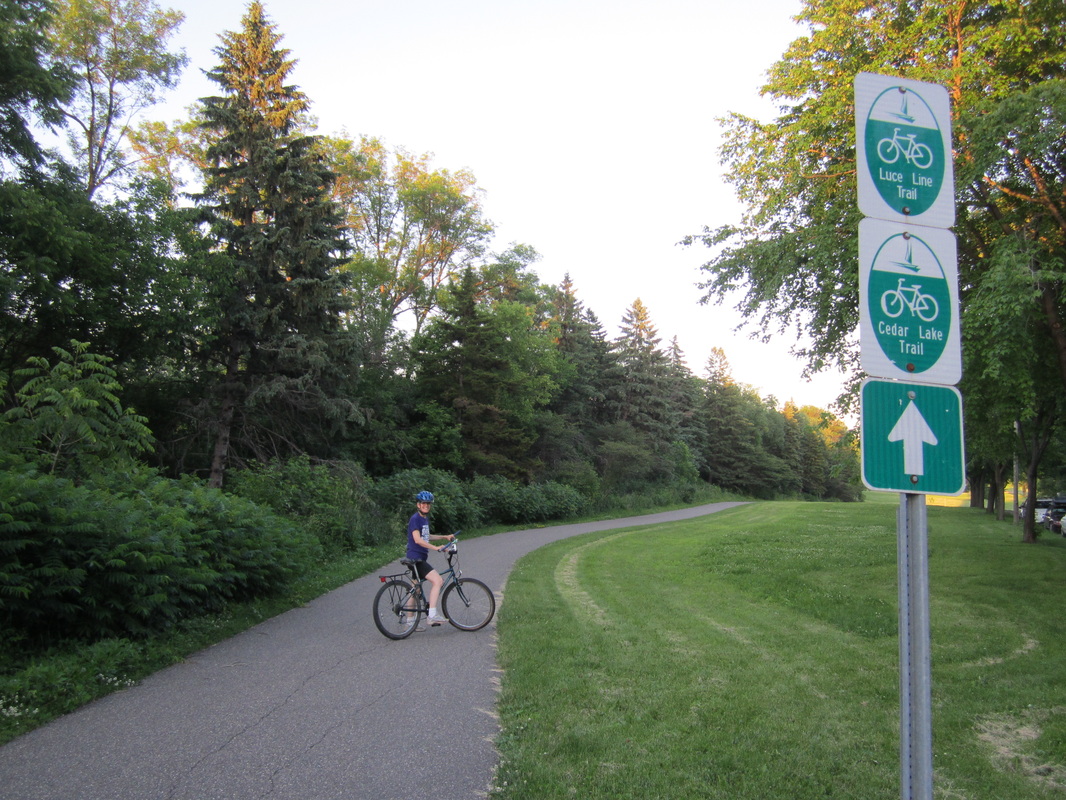
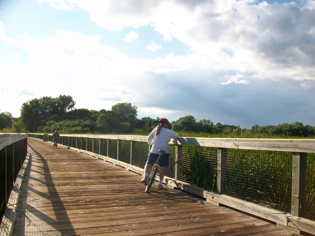
Luce Line Regional Trail (a.k.a. Luce Line Extension, section in Minneapolis formerly known as Bassett's Creek Trail)
Length: 11.6 miles
Rating: 4 ½ / 5
Surface: Asphalt (with boardwalk section)
A tour de West Metro suburbs, the Luce Line Regional Trail is not just a link from Minneapolis to the humongous Luce Line State Trail, but a very nice trail in itself, for the most part well signed and maintained. Its beginning as an exit off the Cedar Lake Trail gives no hint that this link can take you all the way to Central Minnesota. A very lightly traveled section leisurely winds along Bassett's Creek. Follow Theodore Wirth Parkway for a bit to access the trail's next section, which zooms into the wooded hills of Theodore Wirth Park. Though it's popular, this section is the most fun. Coming after it, the Golden Valley section is a bit dull, as the trail parallels roads and a railroad track. However, stick with it for the portion in Plymouth, with seemingly endless wetlands and deep, shady forest, an appetizer for what's to come if you continue onto the Luce Line State Trail.
(Last biked July 2015)
Go to http://www.threeriversparks.org/trails/luce-line-trail.aspx for a map and information on the Three Rivers Park District section of the Luce Line Regional Trail.
____________________________________________________________________________________________________________________________________________

|
Medicine Lake Regional Trail
Total Length: 16.0 miles (not including gap) Average Rating: 4 ½ / 5 Surface: Asphalt Southern [Medicine Lake] Segment (6.2 miles, Rating 3 ½) Part of the Medicine Lake Loop, the Medicine Lake Regional Trail is the best route along Medicine Lake to get you up close and personal with the nice, large lake. Beyond the lake, in French Regional Park, the trail passes over several strenuous hills, before losing its signage and paralleling roads for the last couple miles. Pavement conditions are okay, and occasionally terrible. This section has now been connected to the northern section via the extension of Cheshire Parkway -- updates coming soon. (Last biked Sunday, August 10th, 2014, 1 PM to 3 PM) Northern [Fish Lake – Elm Creek] Segment (9.8 miles, Rating 5) For once, the praising description of the trail that you'll find in map kiosks does not exaggerate at all -- this is one of the most beautiful sections of trail in the Twin Cities. It weaves around suburban development the best it can to find a deep covering of trees, passing fields, wetlands, and many small lakes. The leaves are gorgeous in fall, and the gently rolling hills are lovely. (Last biked Saturday, October 11th, 2014, 2 PM to 4 PM) Go to http://www.threeriversparks.org/trails/medicine-lake-trail.aspx for a map and information on the Medicine Lake Regional Trail. |
FYI
Maple Grove is an excellent suburb for bicycling. Accessible from the Medicine Lake Trail's Northern Segment, the Rice Lake Area Trails bring you as close to a lake as you can get without falling in! While there's a portion along 494, and the cracked pavement needs work as of 2014, these trails make a good side trip. |
_______________________________________________________________________________________________________________________________________________
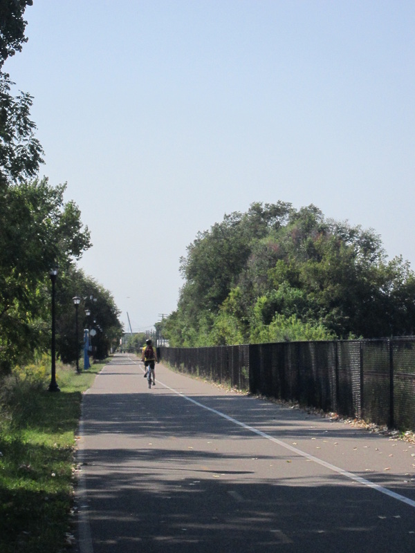
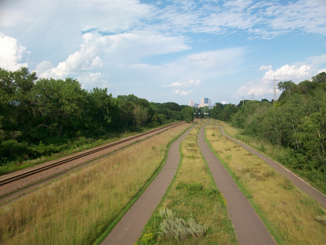
Midtown Greenway
Length: 5.5 miles
Rating: 3 ½ / 5
Surface: Asphalt
The wildly popular Midtown Greenway is the center of the Minneapolis bicycling world. It's a “green” route across Midtown Minneapolis, connecting the river with the LRT trail system and the Chain of Lakes as it barrels under and over streets on a converted railroad grade, always choc-full of commuters thanks to its convenience as a super-fast link across Minneapolis. It's lit at night, plowed in winter, and has been named the best urban bike trail in the country by USA Today. As a recreational trail, most of it is only fun if you like people-watching and the undersides of bridges. The Greenway features the conveniently located Freewheel Bike Center and a really cool cable-stayed bridge that crosses Hiawatha Avenue.
(Last biked Saturday, August 5th, 2017, 2 to 3 PM)
Go to http://midtowngreenway.org/about-the-greenway/map/ for a map and information on the Midtown Greenway.
_________________________________________________________________________________________________________________________________________________________
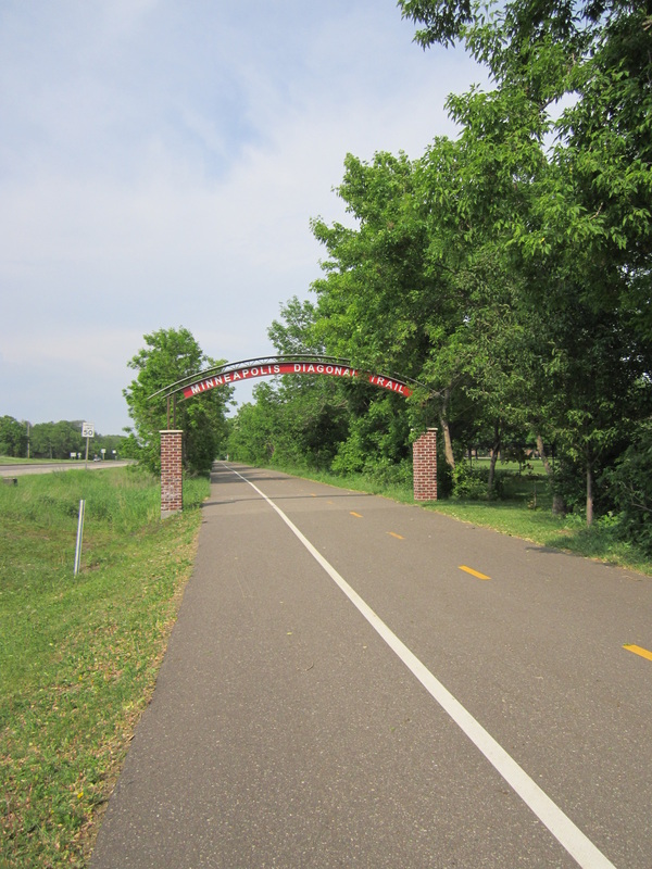
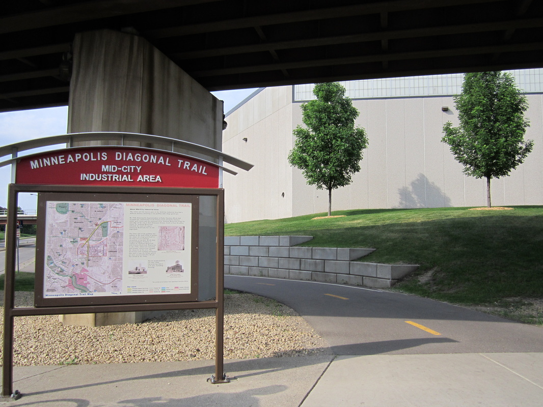
Minneapolis Diagonal Trail
Length: 3.5 miles total; 3.0 miles through
Rating: 3 ½ / 5
Surface: Asphalt (0.5 miles on-road)
The Diagonal Trail, mostly in Northeast and Southeast Minneapolis, is part rail trail and part road parallel. The southern sections are quite industrial, though kiosks describing the area's history add life to the otherwise icky segments. The northern section doesn't need any kiosk-based resuscitation: It follows a pleasant corridor of trees along New Brighton Boulevard and then through quiet Saint Anthony to Walnut Street in Roseville.
(Last biked Sunday, May 12th, 2013, 2:30 PM to 7:30 PM)
______________________________________________________________________________________________________________________________________________________
 The Minnehaha Trail passes a memorial on the site of a concentration camp during the US-Dakota war of 1862.
Minnehaha Trail
Length: 3.7 miles
Rating: 3 ½ / 5
Surface: Asphalt
The scenery is unbeatable on this trail through Fort Snelling State Park, where entrance via bike is free. From the southern end of Minnehaha Park, the trail coasts downhill through beautiful forests and swamps perched above the river, then heads past the park visitor center to Snelling Lake, where if you come at twilight, deer are practically guaranteed. However, the Minnehaha Trail is badly in need of a makeover; in some stretches, the pavement is so bumpy it can barely be ridden on.
(Last biked June 2nd, 2016, 5 PM to 7 PM)
Go to http://files.dnr.state.mn.us/maps/state_parks/spk00154_summer.pdf to download a PDF map of Fort Snelling State Park.
____________________________________________________________________________________________________________________________________________

Minnehaha Parkway Regional Trail (a.k.a. Minnehaha Creek Trail; part of Grand Rounds National Scenic Byway)
Length: 5.6 miles (Minnehaha Ave. to Lake Harriet)
Rating: 4 / 5
Surface: Asphalt (small on-road section near Lake Harriet)
This trail connects Minnehaha Park (don't miss the falls) and Lake Harriet, paralleling Minnehaha Parkway through south Minneapolis. All the while, Minnehaha Creek is nearby, zigzagging across the trail, and offering scenic chances to sit and contemplate life if need be. The trail has the annoyance of crossing numerous thoroughfares at lights, and many places could use re-paving. Its best moments come when it leaves the parkway to follow the tree-lined creek. It also connects to lakes Nokomis and Hiawatha.
(Last biked Tuesday, May 24th, 2017)
The Minnehaha Creek Trail is light blue on this map.
_____________________________________________________________________________________________________________________________________________

Minnesota River Bluffs LRT Regional Trail
Length: 13.1 miles
Rating: 4 / 5
Surface: Crushed Limestone
This trail has lately received less traffic than usual, due to the nicest portion of the trail (the last three miles) being closed due to mudslide damage. From the junction at the Depot Coffee House in Hopkins, the Minnesota River Bluffs Trail is a straight shot southwest through the suburbia of Eden Prairie, featuring pleasant lakes, ponds, and trees. It also features a notably large amount of highway crossings, many of which are made by awkward detours from the main railroad grade. However, the first ten miles are worth it for the last three, where you'll find little development and lots of breathtaking views of the Bluff Creek Ravine and Minnesota River Valley.
(Last biked Saturday, August 5th, 2017, Noon to 2 PM)
Go to http://www.threeriversparks.org/trails/minnesota-river-bluffs-trail.aspx for a map and information on the Minnesota River Bluffs LRT Regional Trail.
_______________________________________________________________________________________________________________________________________________


Minnesota River Bottoms Trail (part of Minnesota Valley State Trail Corridor)
Length: 10.3 miles (Bloomington Ferry Rd. to 11th Ave.)
Rating: 3 ½ / 5
Surface: Natural Surface (dirt, sand, rocks, roots, etc.)
The most notable feature of this popular single track mountain bike trail in southern Bloomington is the raft crossing of Nine Mile Creek. The raft is secured on ropes that you use to pull yourself across the creek. I've never seen anything quite like it.
Raft aside, the Minnesota River Bottoms Trail is very nice as a mountain bike trail, but may be a bit challenging to those who are used to biking on wide paved trails. The three miles from Bloomington Ferry Rd. (the west end) to the Normandale Blvd. Spur (by the railroad bridge) are the nicest, twisting and turning through forests and a few fields on the floodplain. It's not a total escapist trail; on the other side of the river are factories. Due to yearly flooding of the river, sand can make for rough going, especially between the Normandale Spur and Nine Mile Creek. However, it's worth riding that section to get to the raft. The trail eventually gets on a service road and resurfaces at Lyndale Avenue / 35W.
For the adventurous, there's the 2.8-mile section between Lyndale and 11th Ave. / Indian Mounds School. Leaving the river, it weaves up and down the bluff above Long Meadow Lake, with some views. This is true mountain biking, with steep hills, sharp turns, rocks, roots, and many unmarked forks.
(Last biked Friday, August 3rd, 2012, 11 AM to 2 PM)
Go to http://maps.google.com/maps/ms?ie=UTF8&hl=en&msa=0&msid=102925051487865004265.000479206ba7ac7de11f0&ll=44.80084,-93.342934&spn=0.090013,0.154324&t=h&z=13 for a map of the South Bloomington Trail Network.
_____________________________________________________________________________________________________________________________________________
|
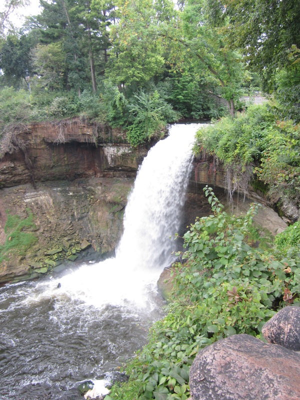
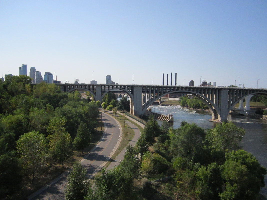
Mississippi River Gorge Regional Trail (a.k.a. West River Pkwy Trail; part of Grand Rounds National Scenic Byway)
Length: 8.5 miles (River Point Cir. to Minnehaha Ave.; not including spurs) Rating: 4 / 5 Surface: Asphalt (boardwalk section outside Mill City Museum) The Mississippi River Gorge Trail follows the mighty river from just north of Downtown Minneapolis all the way to Minnehaha Park. The popular section in the heart of Minneapolis has plenty of the city's top sights, such as the Stone Arch Bridge and the 35W Bridge Remembrance Garden. You'll find it's less busy north of Plymouth Avenue, and has more expansive river views. (You can also ride across the river -- see the spur trail descriptions below.) If you go south, the trail's pavement condition improves past Bohemian Flats, when it climbs out of the river gorge and follows the lip of a steep bluff. The foliage is dense during summer, so you'll have to get off the trail for good views of the gorge, which are provided at overlooks like the one just before 36th Street. The trail here is popular due to the beauty of the river and the absence of lights or stop signs. It ends at Minnehaha Park, a hot spot for Grand Rounds bicyclists where you can watch a plume of whitewater tumble 53 feet into the gorge. (Last biked -- South of Bohemian Flats: Friday, August 15th, 2014, 2 PM to 3 PM North of Bohemian Flats: Saturday, September 6th, 2014, 11 AM to 1 PM) Stone Arch Bridge & Main Street (1.1 miles)
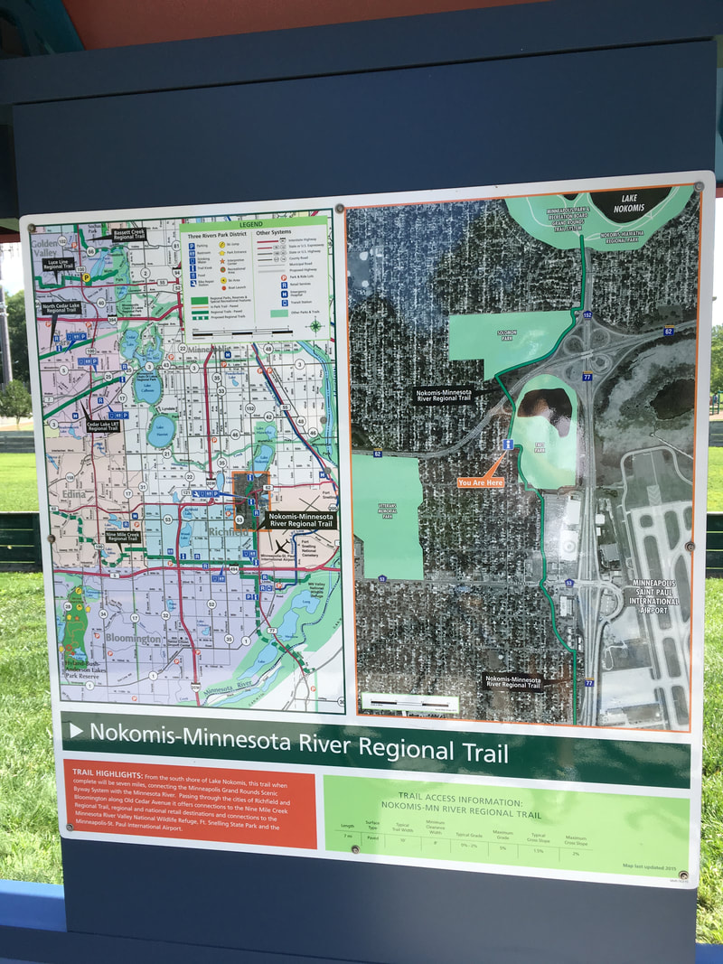
If you head across the iconic Stone Arch Bridge, you'll find a small trail next to Main Street. It's pedestrian-heavy and the pavement is poor, but it provides close-up views of the skyline across the Mississippi River, and of one of Minneapolis' oldest neighborhoods. The trail crosses the Merriam Street bridge to Nicollet Island. (Last biked Saturday, September 6th, 2014, 11 AM to 1 PM) Boom & Nicollet Islands (0.9 miles) Boom Island Park is work a visit. A trail connects it to historic Nicollet Island via a small converted railroad bridge, turning to gravel once it crosses the bridge. You can make a loop using these trails -- see Riverfront Ride. (Last biked Saturday, September 6th, 2014, 11 AM to 1 PM) __________________________________________________________________ Nine Mile Creek Regional Trail Length: 4.9 miles Rating: 2 ½ / 5 Surface: Asphalt and concrete in some portions The Nine Mile Creek Regional Trail is a disconnected trail that in the future will connect two completed ends. This review is for the eastern section. Currently the route is deceptive as both the description of it as a trail and the name of the trail are misleading. It would be generous to call this a trail as most of the path is just a blacktopped sidewalk. As built there is no creek nearby but there are plans to complete the trail on the western end and run near Nine Mile Creek. The route runs west from Edina to east through Richfield and finally ending in Bloomington near the area of the Mall of America and airport. The route mostly runs adjacent to city streets. The pavement is in great condition and the route is well signed. The street crossings with truncated domes at every block can be tiring if riding for a good distance. Cyclists may find using the wide, well maintained bike lanes that run parallel and adjacent to the route in the street to be more pleasant and faster. Towards the eastern end of the trail it runs parallel to American Boulevard in Bloomington. In this section, it is indistinguishable from an ordinary sidewalk. The street offers little in way of concessions to cyclists. Overall the route is well intentioned and built, especially on the section furthest to the west, but is not very fun to bike. (Last biked Saturday, August 12th, 2017, 12 to 1 PM) _____________________________________________________________________________ Nokomis-Minnesota River Regional Trail
Length: 7 miles Rating: 2 / 5 Surface: Asphalt and concrete in some portions The Nokomis-Minnesota River Regional Trail stretches from its namesake Lake Nokomis towards the Minnesota River. The northern third of the route is the most pleasant as the trail squiggles through local parks. The remain 2/3rds is decidedly more urban. The route runs parallel to Cedar Avenue / MN State Highway 77 for several sections which results in a loud unpleasant experience. A section that runs along American Boulevard is not much more than a wider sidewalk. Currently the route does not extend all the way to the Minnesota River but stops at 86th St. An extension is currently under construction. The route is well signed with detailed information and maps at information points and the pavement is for the most part in good condition. (Last biked Saturday, August 12th, 2017, 10 to 11 AM) |
^ The Mississippi River Gorge Trail is gold in the map above.
|


___________________________________________________________________________________________________________________________________________________
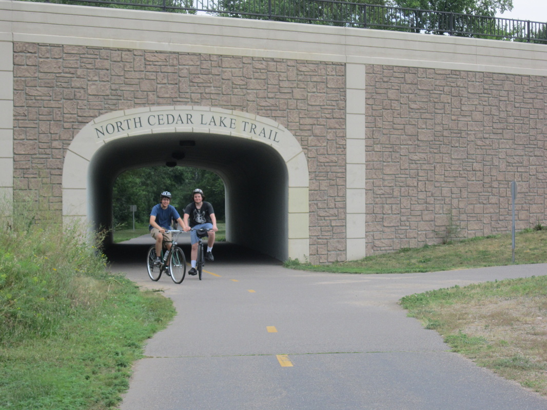
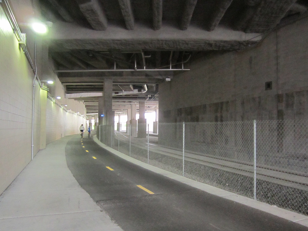
A fancy tunnel on the North Cedar Lake Trail.
North Cedar Lake Regional Trail (previously called Southwest LRT Trail: Hutchinson Spur)
Length: 4.2 miles
Rating: 3 ½ / 5
Surface: Asphalt
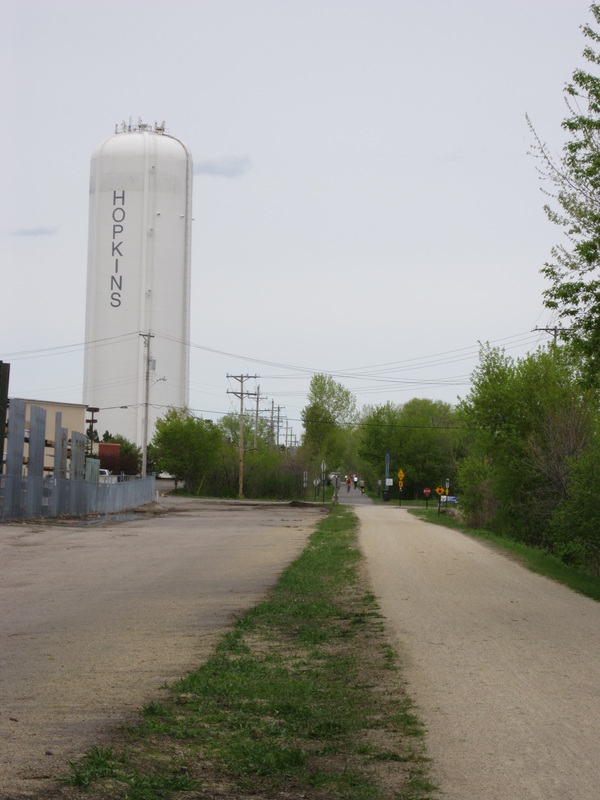
The Cedar Lake Trail becomes the North Cedar Lake Trail at Highway 100 in Saint Louis Park, and continues southeast to the Hopkins junction. It's a cruise through the various landscapes of Saint Louis Park -- trees and parks, as well as industry and housing developments. While still popular, it's the quietest part of the Cedar Lake Loop. You can get foodstuffs at the Depot Coffee House (in a what was one the train station where the name "Hopkins" originated) at the trail's south end.
(Last biked Saturday, August 5th, 2017, 11 AM to Noon)
Go to http://www.threeriversparks.org/trails/north-cedar-lake-trail.aspx for a map and information on the North Cedar Lake Regional Trail.
_________________________________________________________________________________________________________________________________________________________
Length: 4.2 miles
Rating: 3 ½ / 5
Surface: Asphalt
The Cedar Lake Trail becomes the North Cedar Lake Trail at Highway 100 in Saint Louis Park, and continues southeast to the Hopkins junction. It's a cruise through the various landscapes of Saint Louis Park -- trees and parks, as well as industry and housing developments. While still popular, it's the quietest part of the Cedar Lake Loop. You can get foodstuffs at the Depot Coffee House (in a what was one the train station where the name "Hopkins" originated) at the trail's south end.
(Last biked Saturday, August 5th, 2017, 11 AM to Noon)
Go to http://www.threeriversparks.org/trails/north-cedar-lake-trail.aspx for a map and information on the North Cedar Lake Regional Trail.
_________________________________________________________________________________________________________________________________________________________


|
North Mississippi Trail
Length: 9.9 miles Rating: 3 / 5 Surface: Asphalt This suburban trail is the quickest and easiest way to get from North Minneapolis to Coon Rapids Dam. At the south end, North Mississippi Regional Park is hidden away but worth exploring and easily accessible via trails from Webber Park and the Camden Bridge. Big, bad I-94 on the other side of the sound wall is surprisingly un-bothersome, and you might really enjoy the peaceful blue entity slipping past to the east. The trail stops at 694 but picks up again a few blocks to the north on Willow Lane. The trail here is in much better condition, and there's less noise as it parallels quiet West River Road. But, while signage has recently been added, river views all but vanish. The trail is very little known, but it's not interesting enough to deserve serious attention. If you're going to the dam, continue past it for expansive views of a wide spot in the river. (Last biked Friday, June 12th, 2015, 10 AM to 3 PM) Go to http://www.threeriversparks.org/parks/north-mississippi-park.aspx for a map and more information on North Mississippi Regional Park. |
FYI
Trails along 49th and 70th/69th Avenues connect the North Mississippi Trail with the Shingle Creek Trail. An "up one river bank, down the other" loop (using the North Mississippi Trail and the Mississippi River Trail) from the Camden Bridge to Coon Rapids Dam is 20.1 miles. |
_________________________________________________________________________________________________________________________________________________________
Rush Creek Regional Trail (previously called North Hennepin Trail)
Length: 5.5 miles
Rating: 4 ½ / 5
Surface: Asphalt
The Rush Creek Trail is the quintessential suburban bike trail, connecting Coon Rapids Dam Regional Park to Elm Creek Park Reserve. It seems as though there is never a straightaway, with every curve presenting another. The trail is wonderfully maintained, with smooth pavement and plenty of signage. Though you can occasionally see suburban homes through the trees, much of the trail is thickly forested and feels remote.
(Last biked Sunday, September 15th, 2013, morning)
Go to http://www.threeriversparks.org/trails/rush-creek-trail.aspx for a map and information on the Rush Creek Regional Trail.
________________________________________________________________________________________________________________________________________________________
East of Deming Heights, the Saint Anthony Parkway Trail follows a double sidewalk.
Saint Anthony Parkway Regional Trail (part of Grand Rounds National Scenic Byway)
Length: 3.4 miles (Stinson Blvd. to Camden Bridge)
Rating: 4 / 5
Surface: Asphalt & Concrete
This pleasant trail, part of the Grand Rounds National Scenic Byway, follows residential street Saint Anthony Parkway through the many landscapes of Northeast Minneapolis. It starts out in a hilly neighborhood with many parks (including the highest point in Minneapolis, Deming Heights), then crosses a train yard with views of downtown, and finishes up along the Mississippi River. It's a fun and rewarding ride.
(Last biked Monday, June 23rd, 2014, 11 PM to 1 PM)
The Saint Anthony Parkway Trail is brown on this map.
_________________________________________________________________________________________________________________________________________________________
|
Shingle Creek Regional Trail
Length: 8.4 miles (Lions Park to Rush Creek Trail) Rating: 2 ½ / 5 Surface: Asphalt & Concrete The recently re-vamped southern part of the Shingle Creek Trail, which continues into Brooklyn Center from the end of the Shingle Creek Parkway Trail, is very worthwhile for its bird-filled wetlands along Shingle Creek. It also features a loop around the scenic Palmer Lake Basin, where you can glimpse a small lake surrounded by a sea of reeds. North of Palmer Lake, though, the trail is a rather urban conglomerate of newer trail sections, old park trails, and two-lane wide sidewalks. Much of your time there will be spent next to busy roads, next to golf courses, or stopped at unmarked intersections. The trail's northern terminus is at the Rush Creek Trail. (Last biked Friday, June 12th, 2015, 10 AM to 3 PM) Go to http://www.threeriversparks.org/trails/shingle-creek-trail.aspx for a map and information on the Shingle Creek Regional Trail. |
ALTERNATE ROUTE
If you want to stick with the creek for as long as possible, you can take a slightly less direct route that is more scenic. At Xerxes Ave, continue straight on the Brookdale Park Trail, which follows the creek through a tunnel of cottonwood trees (click to enlarge image at right). Then turn right on Noble Ave., to reconnect with the trail north of 85th Ave. |
______________________________________________________________________________________________________________________________________________
The Shingle Creek Parkway Trail follows Shingle Creek.
Shingle Creek Parkway Trail
Length: 1.8 miles (Webber Park to Lions Park)
Rating: 4 / 5
Surface: Asphalt
This little trail in far North Minneapolis allows you to ride from the Grand Rounds Scenic Byway (at Webber Park) to the Shingle Creek Regional Trail (at Lions Park). It's in a quiet neighborhood, with a nice creek, fun curves, and parks with picnic benches.
(Last biked Monday, June 23rd, 2014, 12 PM to 2 PM)
______________________________________________________________________________________________________________________________________________
Theodore Wirth Trail (part of Grand Rounds National Scenic Byway)
Length: 3.7 miles (I-394 to Lowry Ave.)
Rating: 4 / 5
Surface: Asphalt (with a bit of concrete near 394)
This slightly quieter (but still quite busy) section of the Grand Rounds passes through large, hilly Theodore Wirth Park, paralleling the parkway of the same name. Wirth Park is one of the highest places in Minneapolis, but you'd never know it due the thick forest that prevents any view. The trail is winding and fun, especially at times when it momentarily leaves the road for a slice of tranquility. Watch out for the narrow sections. If you like mountain biking, Wirth Park has a big system.
(Last biked Sunday, August 10th, 2014, 3 PM to 5 PM)
The Theodore Wirth Trail is green on this map.
_______________________________________________________________________________________________________________________________________________
Twin Lakes Regional Trail
Length: 3.2 miles
Rating: 2 / 5
Surface: Asphalt, Concrete, and one completely unmarked on-road section (turn left on Twin Lakes Ave.)
The Twin Lakes Trail is a low-signage hodge-podge of two-lane sidewalks, city trails and city streets that doesn't get a "designated trail" feeling until just before its southwestern terminus. The trail splits off the Shingle Creek Trail at Brookdale Center, and roughly parallels Highway 100 on run-down pavement, with little to no directional signage. Only a fraction of the trail is actually along the Lakes. This trail is incomplete (it will eventually connect to North Mississippi Park and the future Crystal Lake Trail), and Three Rivers should be adding more features soon, so it may get better. Stay tuned.
(Last biked Friday, June 12th, 2015, 10 AM to 3 PM)
Go to http://www.threeriversparks.org/trails/twin-lakes-trail.aspx for a map and information on the Twin Lakes Regional Trail.
_____________________________________________________________________________________________________________________________________________
Victory Memorial Parkway Regional Trail (part of Grand Rounds National Scenic Byway)
Length: 3.3 miles (Lowry Ave. to Camden Bridge)
Rating: 3 ½ / 5
Surface: Asphalt
This stretch of the Grand Rounds is a straight shot along the Minneapolis city limits. Though it's a pleasant and fast way to get from Theodore Wirth Park to Northeast Minneapolis, it's not a destination outright. I usually speed through this one.
(Last biked Friday, June 12th, 2015, 10 AM to 3 PM)
The Victory Memorial Parkway Trail is red on this map.
_____________________________________________________________________________________________________________________________________________
 The West Medicine Lake Trail.
West Medicine Lake Trail
Length: 2.7 miles
Rating: 4 ½ / 5
Surface: Asphalt
The less-traveled side of the 7.6-mile Medicine Lake Loop, this trail begins in French Regional Park and connects to the Luce Line Extension via West Medicine Lake Drive. It branches off the Medicine Lake Trail at Rockford Road -- don't go through the tunnel, instead, follow the sign that says "local trail." It starts next to a busy road, but stick with it for woods and hills, then nice lake shore. Near the south end, West Medicine Lake Park has picnic shelters and a beach.
(Last biked Saturday, October 11th, 2014, 2 PM to 4 PM)
___________________________________________________________________________________________________________________________________________
Hennepin County Rides
(Categorized shortest to longest.)
Medicine Lake Loop (7.6 miles - Plymouth)
This 7.6-mile loop is filled with challenging ups and downs and is now signed with mile markers. Begin at the trailhead just off Highway 169. From there, travel north along the shore on the Medicine Lake Trail, admiring the large and pretty lake as you go. Once you reach the northern part of the lake, the trail climbs sharply out of the lake's steep valley, then drops right back down again, and into French Regional Park on the north side of the lake. Once in the park, the trail ascends back out of the valley. From there, get on the West Medicine Lake Trail, which splits off the Medicine Lake Trail at Rockford Road. (Don't go through the tunnel, instead, follow the sign that says "local trail.") After a short time next to a road, the trail exits the park and drop back down to the lake once again. At the bottom of the hill is West Medicine Lake Park, where you can enjoy a rest or snack. Soon after the park, you reach the Luce Line Extension, which connects to the 63-mile long Luce Line State Trail not far to the right. To continue on the loop, however, turn left, and the lakeshore curves away from the trail, which travels on giant boardwalks across humongous wetlands. You'll get one last glimpse of the lake as you reach the trailhead again.
This 7.6-mile loop is filled with challenging ups and downs and is now signed with mile markers. Begin at the trailhead just off Highway 169. From there, travel north along the shore on the Medicine Lake Trail, admiring the large and pretty lake as you go. Once you reach the northern part of the lake, the trail climbs sharply out of the lake's steep valley, then drops right back down again, and into French Regional Park on the north side of the lake. Once in the park, the trail ascends back out of the valley. From there, get on the West Medicine Lake Trail, which splits off the Medicine Lake Trail at Rockford Road. (Don't go through the tunnel, instead, follow the sign that says "local trail.") After a short time next to a road, the trail exits the park and drop back down to the lake once again. At the bottom of the hill is West Medicine Lake Park, where you can enjoy a rest or snack. Soon after the park, you reach the Luce Line Extension, which connects to the 63-mile long Luce Line State Trail not far to the right. To continue on the loop, however, turn left, and the lakeshore curves away from the trail, which travels on giant boardwalks across humongous wetlands. You'll get one last glimpse of the lake as you reach the trailhead again.
Minneapolis Riverfront (13 miles - Minneapolis)
For the tourist, or local wanting to explore their own city, this is a crash course in Minneapolis (not literally!), featuring some top sights (both historic and modern) and some beautiful backwaters.
Southwest Riverfront
Begin at Boom Island, not an island anymore, and a popular family destination with a tiny lighthouse and picturesque footbridge. Cross the Plymouth Avenue Bridge and head south on the Mississippi River Gorge Trail. After a few hundred feet you'll come to the mouth of Bassett Creek, which you can see through the trees. Soon you'll reach Saint Anthony Falls, on the river itself, which has been modified to the point where it's really just a dam/spillway. The nearby Stone Arch Bridge is a beautiful old bridge. Also nearby is Mill Ruins Park, under the bridge. Next up, you'll pass the Guthrie Theater, then the 35W Bridge Remembrance Garden, which glows blue at night. From there, turn right on 13th Avenue, then left on the Dinkytown Greenway. It crosses the river gorge on a converted railroad bridge that provides outstanding views in either direction.
The Mississippi Gorge
On the other side of the river, take the "trail exit" to the U of M East Bank. Briefly head south on East River Boulevard, and soon you'll see the East Mississippi River Gorge Trail paralleling the road on to the right. After coasting down a huge hill, merge right once you see the sign for East River Flats Park, and get on the East River Flats Trail at the other end of the parking lot (by the U of M boathouse). Though near the geographic center of the cities, this floodplain feels amazingly remote. The most prominent feature is a "river walk," which takes you across the surface of the river, with views up and down the gorge. Just past the end of the river walk and just before the Franklin Avenue Bridge, look for the waterfall on the left (really a storm drain discharge). Though just a trickle in summer, spring runoff gives it energy. Pick up momentum for the huge uphill at the end. At the top of the switchbacking hill, take a sharp right (on the East Mississippi River Gorge Trail again), and cross briefly into Saint Paul. If you're up for another down-and-up, stop at Meeker Island, where an "old wagon road" heads down to the remains of the first lock and dam built on the Upper Mississippi. Continue south to the Lake Street Bridge, and cross it (ideally on the north side) to head back into Minneapolis. Turn right on the other side of the bridge and head down to the West River Road and Mississippi River Gorge Trail (again). Head north (left).
Seward and Cedar-Riverside
Just a little way north along the leafy lip of the bluff, take the iconic Midtown Greenway to the left, heading through quiet Seward. You'll see the striking leaning tower of the cable-stayed Martin Sabo Bridge ahead, and soon you'll see it up close. Just as you're about to cross it, merge right onto the Hiawatha LRT trail, heading north along the LRT Blue Line. Your course north will take you through artistic Cedar-Riverside. Note the multiple trailside murals on the backs of businesses.
Northeast Riverfront
At trail's end, head up Third Street South. Take a right on Park Avenue, then a left on Second Street, and then a right on Portland Avenue. You'll come out at the river just downstream from the Stone Arch Bridge. This time, cross the bridge. On the other side, head left on the trail next to Main Street (or just on the street itself, as the trail's pavement is poor). You'll get some close-up views of the skyline across the Mississippi River, as you ride through one of Minneapolis's oldest neighborhoods. You can ride to a viewpoint of Saint Anthony Falls, in the middle of the river. Cross the Merriam Street bridge to Nicollet Island. (This bridge was once part of the old Broadway Street Bridge further upstream, and was floated down here when the bridge was rebuilt.) Turn right on East Island Avenue just after crossing the bridge. Immediately after the railroad track, merge right onto the gravel trail to Boom Island. A quiet channel of the Mississippi is to your right. A small converted railroad bridge brings you to back to where you started.
Cedar Lake Loop (12 miles from Uptown, 15 miles from Downtown - Minneapolis, Saint Louis Park and Hopkins)
From Uptown or Downtown Minneapolis, head west on the Cedar Lake Trail, Minnesota's first "bike freeway." You'll get some nice views of Cedar Lake from a preserved strip of prairie. Look behind you for a view of the skyline. The trail becomes the North Cedar Lake Trail as it passes under Highway 100 and into Saint Louis Park. A few miles down this suburban trail is a tunnel with the trail's name on it. The trail ends in Hopkins, a bicycle center where four trails meet.
You can stop for ice cream, smoothies or coffee at the Depot Coffee House. (Note that the road crossing to access the Depot is currently being re-done, and requires riding down lanes of traffic in the wrong direction to bypass, which multiple bicyclists do on every light change.) If you want a more substantial meal, a nearby Pizza Luce has been designed with bicyclists in mind. When you're ready, ride the Cedar Lake LRT Trail into Minneapolis, cruising into town on a former railroad grade, and take a slight left onto the Kenilworth Trail, a newer bike freeway, which will probably be the nicest part of your ride. There's lots of trees here, and you will get another view of Cedar Lake itself as you cross Cedar Lake Avenue. The Kenilworth Trail intersects with the Cedar Lake Trail after a little while, completing the loop. While there's sometimes little shade and some crossings are unmarked from the road, the parks, lakes and trees of this loop make it a warranted Minneapolis staple.
Deming Heights to Palmer Lake (20 miles - Minneapolis and Brooklyn Center)
If you don't mind an out-and-back that's mostly next to secondary thoroughfares, this one is a quirky treat, featuring the highest point in Minneapolis, an enormous train yard, the river, a creek and a little-known lake. Begin at Deming Heights Park, Minneapolis's highest point, with a view of the Minneapolis skyline. From there, whiz down to Columbia Park on the Saint Anthony Parkway Trail. Past the park, climb up a hill and cross a bridge over a huge train yard (about 500 feet wide) with clearer views of the skyline, then ride down to the pretty Mississippi River (the trail gets right to the same level). After admiring the river, loop up onto the Camden Bridge, which has the interesting feature of sloping upward to cross I-94 after crossing the river, then steeply down to reach Lyndale Avenue. From there, briefly stay on the Grand Rounds route to cross Webber Park, then get on the Shingle Creek Parkway Trail via 45th Avenue North. Enjoy riding along the wooded creek until Lions Park on the border of Brooklyn Center. This is a good place for a snack, if you desire one.
If you turn back now, it's a solid ten-mile ride, but push on to Palmer Lake on the Shingle Creek Trail if you want the full effect. Recent improvements to the trail have made this suburb's bird-filled wetlands more enjoyable. And then you reach the lake basin, where, through gaps in a dense forest, you can glimpse a small lake surrounded by a sea of reeds.
Minneapolis Grand Rounds (35 to 40 miles - Minneapolis)
The Grand Rounds National Scenic Byway is a collection of connecting parkways that spiral through Minneapolis, most of which have bike trails paralleling them. Though not a full loop, it can be turned into one by making use of some of the city's many bike lanes. If you don't mind following minor roads on heavily traveled trails, it's the Twin Cities' premier bike circuit, and offers a tour of Minneapolis' many sides, perfect for those who love to bike and those meeting the City of Lakes for the first time. Those who want a shorter ride can use the Cedar Lake Trail to divide it into two possible loops.
Minnehaha Creek
You can start anywhere, but I recommend Minnehaha Park, which is mile zero on the big loop's mile markers. Don't miss its 53-foot cascade, which has inspired many a work of art. Head west, up the quiet creek on the Minnehaha Parkway Trail. Soon you'll reach lakes Hiawatha and Nokomis. Though it adds three miles to your trip, Nokomis is a lovely lake to loop around. West of Nokomis, the trail is closer to Minnehaha Parkway, but still follows the peaceful creek.
The Chain of Lakes
Eventually, you reach busy Lake Harriet, which is a pretty lake full of all forms of transportation and recreation (driving, biking, walking, paddling, sailing, swimming). Halfway along the one-way loop, part of the Chain of Lakes Trail, take a right on the connector trail to Lake Calhoun, which is bigger, rounder, sunnier, and even busier. Turn right on another access trail, then left to take in the corner of Lake of the Isles. After that, head west (left) on the trail next to Dean Parkway. Turn right on the trail next to Cedar Lake Avenue. Once you get to the north end of beautiful Cedar Lake, veer left (up the hill) and you'll find yourself following a ridge overlooking tiny Brownie Lake. The trail gets narrow and bumpy here, but it soon expands into the Theodore Wirth Trail once you cross I-394.
Theodore Wirth Park & Victory Memorial Parkway
Wirth Park is Minneapolis's largest, and is wonderfully forested and full of plenty of attractions (though few are right on the parkway and trail). North of Plymouth Avenue, you'll see Bassett Creek far below to your left. After heading through the park, the Wirth Trail becomes the Victory Memorial Parkway Trail. This parkway is a straight shot through Camden, conceived as a block-wide firebreak. You'll make a sharp turn east about two-thirds of the way in, and that's the only curve until you get to Webber Park. If you want to stop, check out the human-made waterfall on Shingle Creek in Webber Park before turning right on Lyndale momentarily, then left on 42nd Ave across the Camden Bridge to Northeast.
Northeast & Southeast Minneapolis
Keep left and loop under the bridge to get on the Saint Anthony Parkway Trail. You'll get a little time by the Mississippi River, cross a huge train yard, and pass Colombia Park before scaling the heights -- Deming Heights. To stand at Minneapolis's highest point, head up the knoll to the left once you get to Deming Heights Park. This is a good spot to rest: There's a skyline view, but the place is wooded and only glimpses through the trees show the steepness of this hill's southern face. Once you're ready to move on, head down the other side of the hill and continue following the Saint Anthony Parkway Trail to Stinson Parkway. You'll have to go on the road on this one, but parkways are designed with bikes in mind. At New Brighton Blvd., you'll see the Diagonal Trail on both sides of the road. Cross Stinson, and continue south on the trail the parallels Stinson on the left (don't go through the huge arch that says "Minneapolis Diagonal Trail"). For one of the best views of downtown, take a side trip left onto Ridgeway Parkway and head up the hill. The Diagonal Trail continues south, becoming increasingly industrial. Soon, the trail becomes a route, getting on 18th Avenue. Turn right on Como Avenue, where a bike lane starts up after two blocks. Then turn left on 10th Avenue, which parallels 35W. Turn right on 5th Street, crossing a bike & pedestrian bridge over 35W. Past 8th Avenue, 5th street is a one-way the other way for cars, but a special lane allows bikes to go both ways. Turn left on 6th Avenue, where another bike lane will pick up after University. Sixth descends to the river.
The Downtown Riverfront
You can bypass most of the Downtown Riverfront by continuing straight onto the Stone Arch Bridge, but for those who want to do the whole thing, turn right on the trail next to Main Street (or just on the street itself, as the trail's pavement is poor). You'll get some close-up views of the skyline across the Mississippi River. Dam buffs can head out to a viewpoint of Saint Anthony Falls, in the middle of the river. Cross the Merriam Street bridge to Nicollet Island. (This bridge was once part of the old Broadway Street Bridge further upstream, and was floated down here when that bridge was rebuilt.) Turn right on East Island Avenue just after crossing the bridge. Immediately after the railroad track, merge right onto the gravel trail to Boom Island. A quiet channel of the Mississippi is to your right. A small converted railroad bridge brings you to Boom Island, not an island anymore, featuring a tiny lighthouse and picturesque footbridge. Cross the Plymouth Avenue Bridge, and head south on the Mississippi River Gorge Trail. After a few hundred feet you'll come to the mouth of Bassett Creek, which you crossed in Wirth Park. Soon you'll reach Saint Anthony Falls, on the river itself, which has been modified to the point where it's really just a dam/spillway. The nearby Stone Arch Bridge is lovely and worth checking out. Next up, you'll pass the Guthrie Theater, then the 35W Bridge Remembrance Garden, which honors the thirteen people who were killed when the 35W bridge collapsed in 2007.
The Mississippi Gorge
The trail goes under the new 35W bridge as it leaves downtown, and passes through the Bohemian Flats (a former neighborhood) before climbing the bluff above the Mississippi River's only true gorge. The trail follows the lip of the gorge for the final few miles of your ride. The forest is dense, so you'll have to get off the trail for good views of the gorge, which are provided at overlooks like the one just before 36th Street. You'll find views like these a fitting finale before you head away from the river and back into Minnehaha Park.
Midtown - Minnetonka Route (40 miles - Minneapolis, Saint Louis Park, Hopkins, Minnetonka, Deephaven, Greenwood and Excelsior)
This out-and-back is a perfect ride if you want to observe the gradual transition from urban to suburban to rural. Hook up with the Midtown Greenway anywhere in Minneapolis, and head west. Just keep going straight, and the Greenway turns into the Cedar Lake LRT Trail at the Minneapolis City Line. Through the leaves and suburbs you'll approach Hopkins, where you could get a snack at the conveniently placed Depot Coffee House (in a what was one the rail station where the name "Hopkins" originated).
From there, follow signs for the Lake Minnetonka Trail through the historic city center (your short route is along 8th Ave.). In no time at all, you'll find the Lake Minnetonka LRT Trail, your route through the pretty forests and wetlands of Minnetonka. Watch for Minnehaha Creek, which passes through some of those aforementioned wetlands and is on the other side of Minnetonka Boulevard on the slightly duller section when the trail parallels that road. The houses gradually thin out. After all these "Minnetonka" misnomers, it feels wonderful to actually prove that the lake is there when you burst onto the shore in Greenwood.
Soon after, you reach Excelsior. Originally founded as a tourist destination on the big lake, it is now a triple-dollar-sign historic little town. The ride is 40 miles if you turn back now, but if you can spare a few miles, continue past Excelsior and complete the transition: even though you're technically still in the suburbs, development is very thin. The trail terminates in Victoria, six miles beyond Excelsior. As you retrace your steps to Minneapolis, you could have dinner at the Pizza Luce along the Cedar Lake LRT Trail.
Great Northwestern Circuit (47 to 49 miles - Minneapolis, Fridley, Coon Rapids, Brooklyn Park, Maple Grove, Plymouth and Golden Valley)
Everyone seems to think that rail trails are the big cheese. Maybe they are, but the Northwest Metro has several major trails that are not ex-railways, and therefore bounce and curve through more natural-feeling lands. This enormous loop shows you the best of these.
The Mississippi River
Begin at the parking lot at Wirth Parkway and Plymouth Avenue, and head north on the Theodore Wirth Trail, which parallels Wirth Parkway through Minneapolis's largest park. It becomes the Victory Memorial Parkway Trail, a straight shot through Camden. Check out the human-made waterfall on Shingle Creek in Webber Park before turning right on Lyndale momentarily, then left on 42nd Ave across the Camden Bridge to Northeast. Now things get interesting. Rather than heading south, get on the Mississippi River Trail, heading north. It starts next to a road, but soon you'll find yourself zipping between trees in parks along the river. North of 694, the trail traces a route on many paths and streets, but every turn is marked by a trusty blue sign reading "Mississippi River Regional Trail Corridor." A couple miles north of 694, there's a nice viewpoint of Locke Lake that's worth stopping for. A couple miles north of that, the trail follows Riverview Terrace, a street right down on the wild river. Soon after entering Coon Rapids, the trail descends into Coon Rapids Dam Regional Park, down on the floodplain. Your approach to the dam itself is dramatic: It gradually comes into view as the river curves.
Elm Creek Park & Around
Ride across the top of the dam into Brooklyn Park, and get on the Rush Creek Trail, which begins outside the park entrance. The trail is ridiculously curvy and lushly forested, making it a lot of fun. Watch for deer. Five miles straight west of Coon Rapids Dam is Elm Creek Park Reserve, the largest park in the metro. You can stay in the "frontcountry," or, if you are up for adding a few miles to your trip, loop into the exciting woods. A loop around Mud Lake adds 2.3 miles and features a nice view over the lake and distant, striking chalet. When you're done in the park, get on the Medicine Lake Trail on the park's southwest edge. At first it may seem that you have returned to civilization, but do not be deceived. The trail soon whisks you away into wetlands and woods that feel very remote. You'll glimpse Rice Lake, cruise through Fish Lake Park, and pass Edward Lake.
Medicine Lake and the Luce Line
All good things must come to an end: The trail resurfaces next to roads, following Cheshire Parkway, Shmidt Lake Road and Northwest Boulevard. It eventually curves away from Northwest Boulevard to pass through French Regional Park, where the amount of steep ups and downs is outrageous. It finally descends for good to Medicine Lake and follows the shoreline for a few scenic miles. In East Medicine Lake Park at the south end of the lake, turn left on the Luce Line Trail. Watch for the Minneapolis skyline up ahead. For most of the way through Golden Valley the trail is a little boring, but stick with it for thick woods and some of the ride's most fun hills as the trail enters Wirth Park -- a worthy finale to an epic ride. Before long, you'll pop out at Wirth Parkway, and the parking lot is just a short hop north.
